No Products in the Cart
Call Us: +1 866 300 9012
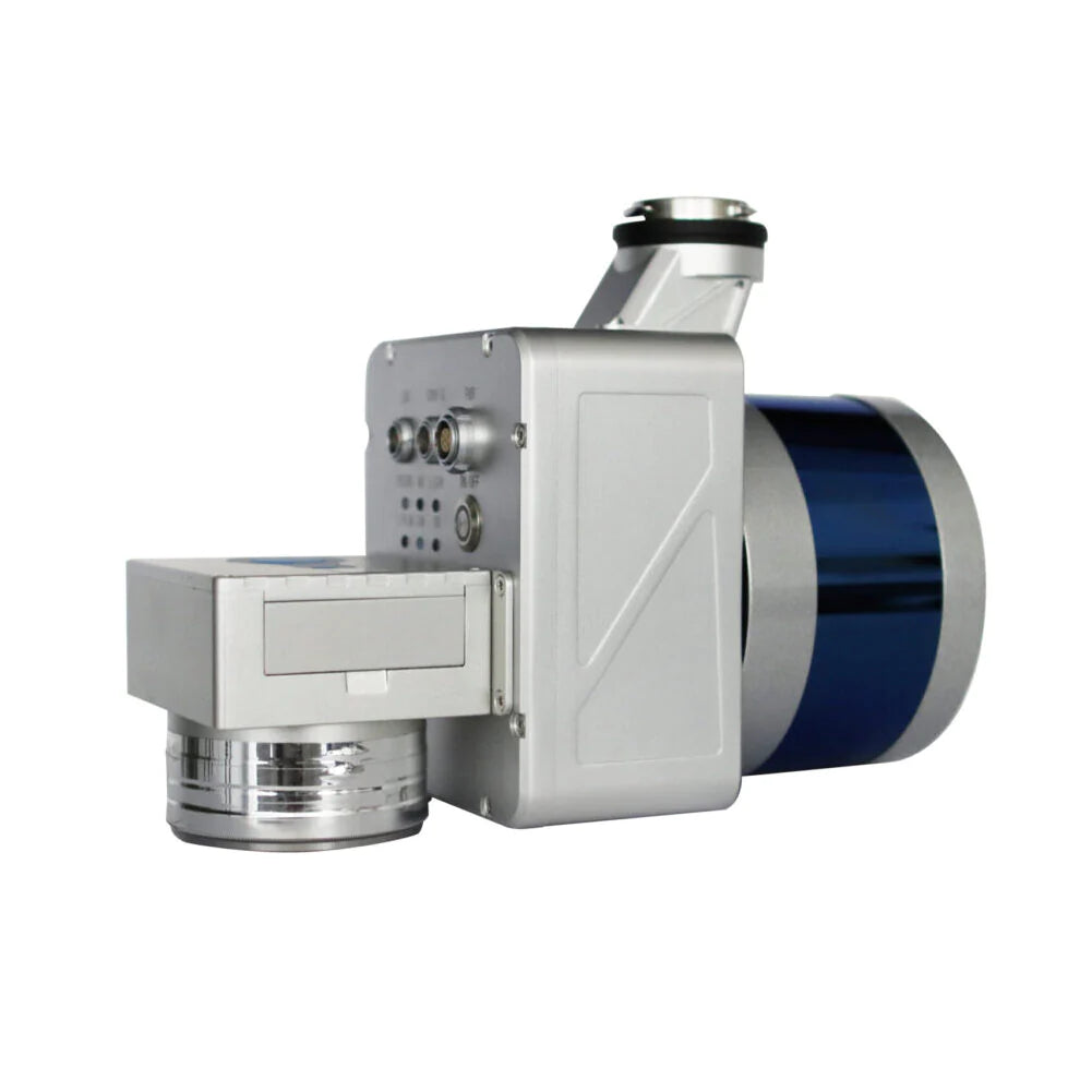
contact@measur.caThe LiAir 50N is specifically designed to work with DJI's Matrice 600 Pro and DJI M300 RTK platforms, enabling highly accurate 3D point cloud data to be collected. This system is suitable for various applications across many industries including forestry, mining and terrain. Additionally, the LiAir 50N comes equipped with a high-definition digital camera that can generate photogrammetry products and true colour 3D point clouds.
The GreenValley LiAir 50N LiDAR survey instrument can be mounted on both, unmanned aerial vehicle (UAV) or small unmanned aircraft system (sUAS). This lightweight system is part of GVI's LiAir Series and features Velodyne's Puck laser scanner, making it one of the most cost-effective LiDAR systems available from GVI.
|
Range Accuracy ±3 cm
|
Weight
1.4 kg(Incl.Camera)
|
|
Specifications
Laser Sensor: Velodyne's Puck
Range Accuracy: ±3 cm
Detection Range 100 m @ 20% reflectance
Channels: 16
Power Consumption: 17 W
System Accuracy: ± 5 cm
POS System Performance: Attitude: 0.008° (1σ) Azimuth: 0.038° (1σ)
Working Temperature: -20 ℃ - 40℃
Mounting Platform: DJI’s Matrice 600 Pro, M300 RTK
Camera (Optional): Sony A5100
Weight: 1.4 kg (Incl. Camera)
Dimensions (Incl. Camera): 200* 105* 160 mm
Acquisition/PP POS Software: LiAcquire Web & LiGeoreference
Field of View: 360° (Horizontal) 30° (Vertical)
Scan Rate: 300,000 pts (Single Return ) 600,000 pts (Dual Return )