No Products in the Cart
[Webinar] ScoutDI: Revolutionizing Confined Space UTM Inspections. Register Now
Call Us: +1 866 300 9012
contact@measur.caCall Us: +1 866 300 9012
contact@measur.caThe LiHawk is a cutting-edge aerial LiDAR surveying system specifically designed for large-scale and long-range 3D data collection projects.
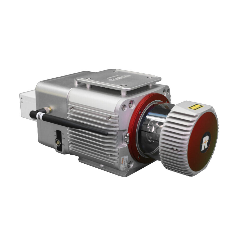
The system can be easily mounted on either a fixed-wing airplane platform or a multi-rotor UAV, and it features the highly precise RIEGL VUX-1LR laser scanner combined with a state-of-the-art inertial measurement unit (IMU). This advanced system is particularly well-suited for projects that require mapping of terrain features beneath forest canopies and extracting structural parameters from forest LiDAR data.
The LiHawk's measurement accuracy, which is at the centimeter-level, meets the demands of civil engineering and critical infrastructure maintenance professionals. Additionally, the system's high-definition digital camera module enables the creation of photogrammetry products and true colour 3D point clouds during each LiDAR survey.
|
Max. Measurement Rate 750,000 pts/sec |
Scan Range 1350 m ( @Reflectance ≥ 60%) |
|
Scan Rate 10 Hz -200 Hz |
Specifications
Laser Sensor: Riegl VUX-1 LR
Max. Measurement Rate: 750,000 pts / sec
Scan rate: 10 Hz -200 Hz
Field of view: 330°
Scan Range: 1350 m @ Reflectance ≥ 60%
System Accuracy:
Flight Height: 200 m
Horizontal Accuracy: < 10 cm
Vertical Accuracy: < 10 cm
POS System Performance: Attitude: 0.005 ° (1σ). Azimuth: 0.009° (1σ)
Weight Incl.Camera: 4.35 kg
Dimensions (Main Unit): 297 * 180 * 147 mm
Camera: SONY A7RII (24 mm prime lens)
Acquisition Software: LiAcquire-VUX
Post-processing software: LiDAR360/LiPowerline (optional) LiMapper (optional)