[Webinar] ScoutDI: Revolutionizing Confined Space UTM Inspections. Register Now

Call Us: +1 866 300 9012

contact@measur.ca

Call Us: +1 866 300 9012

contact@measur.ca
SHOPPING CART

No Products in the Cart

TOTAL:
$0.00

Combining drone photos and 3D laser scans with FARO Zone 3D Expert Software

The ability to capture high-resolution images and accurate point cloud data has opened up new possibilities for professionals in various industries, from architecture and construction to surveying and forensic analysis. One software that has played a key role in harnessing the power of these two technologies is FARO Zone 3D Expert Software.
FARO Zone 3D Expert Software is a powerful tool that allows users to process, analyze, and present data collected from both drones and 3D laser scanners like the FARO Focus. Its intuitive interface and advanced tools make it an indispensable asset for professionals seeking to optimize their 3D models and streamline their workflows.

Key Features of FARO Zone 3D Expert Software

One of the key features that sets FARO Zone 3D Expert Software apart from other software is its seamless integration of drone photos and 3D laser scans. Users can easily import and align their captured data, enabling them to create comprehensive and accurate 3D models. Additionally, the software offers powerful visualization capabilities, allowing users to explore their models from various perspectives and manipulate them in real-time. Furthermore, FARO Zone 3D Expert Software provides a range of analysis tools, such as line-of-sight and cross-sectional analysis, facilitating data interpretation and decision-making.

The Power of Drone Photography in 3D Modelling

The utilization of drone photography in 3D modeling has revolutionized the way professionals collect and analyze data. By capturing high-resolution aerial images, drones provide a unique perspective that was previously unattainable. This aerial perspective allows for the creation of highly accurate and detailed 3D models, which can be used for a myriad of purposes, ranging from urban planning and environmental monitoring to archaeological documentation.

The Role of 3D Laser Scanning in Data Collection

While drone photography provides a valuable aerial perspective, 3D laser scanning allows professionals to acquire accurate and detailed point cloud data from ground level. 3D laser scanning relies on the principle of measuring the time it takes for a laser beam to travel to an object and back, resulting in a highly precise representation of the physical environment. This technology has revolutionized industries such as architecture, engineering, and construction, facilitating accurate as-built documentation and efficient design processes.

Integrating Drone Photos and 3D Laser Scans with FARO Zone 3D

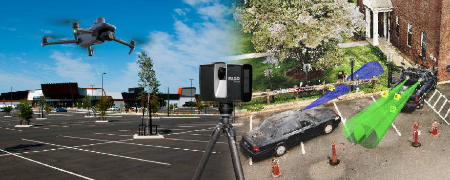
The process of integrating drone photos and 3D laser scans begins with the acquisition of aerial imagery using drones equipped with high-resolution cameras. These drones are deployed to capture photographs from various angles and altitudes, while simultaneously, 3D laser scanners collect precise point cloud data representing surface geometry.

Once acquired, the drone photos and 3D laser scans are synchronized and aligned within FARO Zone 3D Expert Software. This involves geo-referencing both datasets to ensure spatial accuracy and consistency, achieved through advanced algorithms that match corresponding points.

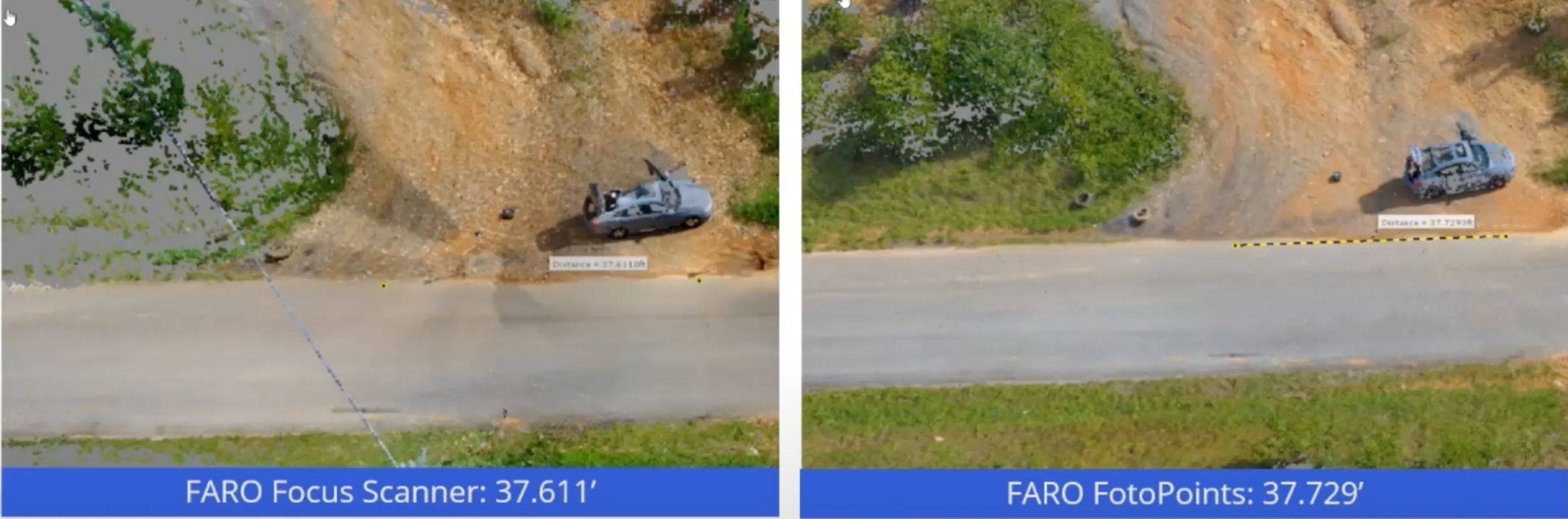
With the datasets synchronized, the software processes the 3D laser scans to generate detailed point cloud representations. Simultaneously, the drone photos undergo photogrammetric processing to create high-resolution orthomosaics and 3D models of the terrain and objects.

The integrated dataset, comprising both the point cloud and drone imagery, is then visualized within the FARO Zone 3D Expert Software environment. Users can explore and analyze the scene in a unified interface, gaining valuable insights into spatial relationships and structures.

Accuracy

On the left side of the image, you'll notice the Faro laser scan, known for its exceptional precision with an accuracy of approximately ±1 millimeter. On the right side, we have the point cloud generated by the drone. The Faro scan measures 37.611 feet, while the drone data, compiled using the photo points feature from aerial images, reads 37.729 feet. This minor deviation of 0.118 feet demonstrates the drone photos' accuracy, falling comfortably within acceptable parameters.

Empowering Analysis and Decision-Making

FARO Zone 3D Expert Software offers a suite of tools for analysis and measurement, enabling users to extract valuable information from the integrated dataset. This includes measuring distances, volumes, and angles, performing line-of-sight analysis, and conducting virtual inspections of structures.
The integration of drone data with FARO Zone 3D Expert Software has far-reaching implications across various industries. In surveying and mapping, it enables the creation of highly detailed and accurate representations of physical environments. In public safety and law enforcement, it facilitates forensic investigations, accident reconstructions, and environmental assessments with precision and accuracy.

RELATED POSTS

[WEBINAR REWIND] How Suncor Utilizes Drones to Manage one of Canada’s Largest Drone Programs with Measur and Flight Insight
In the ever-evolving landscape of technological innovation, industries are constantly seeking new ways to enhance efficiency, safety, and environmental responsibility....
The Ultimate Guide to Ground Penetrating Radar (GPR)
Ground Penetrating Radar (GPR) is a geophysical technique that uses electromagnetic waves to create subsurface images and detect objects buried...
The Importance of Indoor Drone Inspections with Scout 137
Traditional methods of confined space inspections often involve sending human inspectors into hazardous environments. However, with the advancement of technology,...

Get in touch

Give us a call or drop by anytime, we will answer all enquiries within 24 hours on business days. We will be happy to answer your questions.

Contact Information

We would love to hear from you! Our team is always here to help.

  • +1 866 300 9012

  • contact@measur.ca

  • Vancouver, British Columbia

    Calgary, Alberta

    Mississauga, Ontario

    Montreal, Quebec

Name*:

Phone*:

Email*:

Message:

BACK TO TOP