No Products in the Cart
YellowScan’s product line is fully-integrated with embedded laser scanner, INS, GPS, batteries, and onboard computing. Each system is designed to meet high precision and accuracy needs for 3D mapping.
Fully integrated LiDAR solutions with all the tools and customer support (hardware, software & services)
Optimize your workflow, expand your business, reduce your worries
Benefit from YellowScan’s outstanding user experience, and take advantage of our customer support from pre-sales to field operations
Easy LiDAR data acquisition to be more productive in the field
Mapping through the forest canopy to speed up discoveries
Mapping to help with leveling, planning and infrastructure optimizations or clean up after natural disasters
Powerline survey to detect line sagging issues or vegetation encroachment
Surface/volume calculations to optimize mine operations or decide on mine extensions
Mapping forests to optimize forest management efforts
Measuring vegetation growth speed & disease spreading rates
Advanced performance fitted into a compact survey solution.
The YellowScan Mapper+ integrates Livox AVIA laser scanner together with high performance GNSS-aided inertial navigation system into a lightweight, standalone and easy-to-use lidar system
SOLID PERFORMANCE AT A FRACTION OF THE COST & WEIGHT
YellowScan Mapper UAV LiDAR system is equipped with a high-performance Livox Horizon laser scanner from Livox, a DJI-backed company. With a great point density, this LiDAR sensor allows our LiDAR system to fly easily at 70m AGL with a 120m swath.
HIGH-DENSITY AND LONG-RANGE UAV LIDAR
YellowScan Surveyor Ultra LiDAR system is suited for high speed UAV (VTOL fixed-wing or helicopter) and long-range needs due to its high-density specifications.
With the 360° Field of View of the Hesai XT32M2X Laser Scanner, YellowScan Surveyor Ultra is matching vertical mapping and mobile mapping needs when combined with Fly&Drive.
FLY WHEN YOU CAN, DRIVE WHEN YOU MUST
The YellowScan Fly & Drive is a versatile land vehicle-mounted or UAV-mounted mobile mapping system which combines high resolution laser scanning and precise positioning to collect geo-referenced point clouds for a wide range of applications.
LONG-RANGE AND HIGH-ACCURACY RIEGL LIDAR
YellowScan designed an all-integrated, easy-to-use LiDAR system that includes the renowned Riegl laser scanner and Applanix UAV IMU APX-15. YellowScan Vx-15 is an excellent solution for your high flight UAV projects with short-time data processing needs. It is ideally sized for all types of UAVs.
THE MOST ACCURATE AND HIGH-PRECISION UAV LIDAR SYSTEM
YellowScan Vx20 is the most accurate fully integrated system from YellowScan’s product range. It can fly up to 100m while maintening accuracy throughout the point cloud. The Vx20 series is ideally suited for applications that requires sharp and accurate descriptions.
LONG-RANGE AND MULTI-PLATFORM LIDAR SOLUTION
The YellowScan Explorer is the first LiDAR that can be mounted on a light manned aircraft or helicopter and be switched to a UAV platform like the DJI M300. This versatility allows the end user to tackle a wide range of projects with the proven ease-of-use of YellowScan’s UAV LiDAR solutions.
HIGH-PRECISION AND MULTI-PLATFORM LIDAR SOLUTION
The YellowScan Voyager is the newest LiDAR solution with the highest accuracy, it can be mounted on a light manned aircraft or a UAV platform.
ONE SOFTWARE TO EDIT YOUR POINT CLOUDS
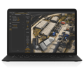
YellowScan CloudStation provides a complete software solution to create and manipulate point cloud data. It allows to extract, process and display data immediately after the acquisition flight. The auto-generation of strips and the production of LAS files are now done in only few clicks.
POINT CLOUD ENHANCEMENT TOOL FOR CLOUDSTATION
Even with high-end systems, some data refinement is required to improve precision and accuracy; the catch is that strip adjustment software is often complex. Here, the adjustment of strips or flight lines and the production of LAS files are done in only a few clicks.
EXPORT CLASSIFIED POINT CLOUDS FROM CLOUDSTATION
The Terrain module is providing a better and simplified experience for the customers to extract classified point cloud, this leads to more efficiency and time saving.
EXPORT COLORIZED POINT CLOUDS FROM CLOUDSTATION
The Colorization module allows you to combine the point-cloud data you have generated from a flight and combine it with multiple photos taken simultaneously, thus generating a colorized point-cloud. The Colorization process automatically refines the camera alignment with the LiDAR on a per-flight basis ensuring the quality of the final colorized product.

REAL-TIME, IN-FLIGHT MONITORING SOLUTION
YellowScan’s LiveStation provides system operators with the immediate and relevant information needed to ensure a smooth acquisition even in difficult working conditions. It provides a real-time, three-dimensional representation of the point cloud during flight, with ability to zoom, translate or rotate.
EASILY MOUNT YOUR LIDAR SOLUTION
EASILY MOUNTED ON THE DJI M600 AND DJI M300 PLATFORMS
M600 MOUNT COMPATIBLE