No Products in the Cart
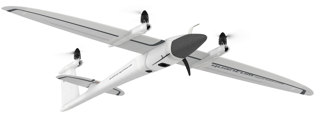
Easy and safe handlingA push of a button is enough and the UAV will do its assigned job. The remote control has a clean layout without confusing switches and levers. The TrinityF90+ and the remote controller work together seamlessly to get your job done automatically, while still providing emergency override capabilities. Thanks to Quantum’s sophisticated electric VTOL design your investment is never in danger due to a flawed hand launch or a rough belly landing.
|
Longest flight time in its classThe ability to switch to gliding mode enables the TrinityF90+ to directly benefit from an enhanced long range capability. We dedicated many hours to optimize the wing geometry to push the glide ratio to an astounding 14:1! Using only one specially-designed motor in the rear fuselage increases the flight time far beyond current industrial UAVs by reducing energy consumption to a minimum.
|
Reliable and integrated designWe designed the TrinityF90+ as a product that meets the requirements of professionals. We started from scratch with a highly integrated industrial product in mind. You can see the result in every detail, such as the optimized electric layout, the efficient cargo container or the clean finish of the outer shell. It truly showcases the best of German engineering. |
Small footprintThe TrinityF90+ comes “ready to fly” (RTF) in a moulded transport case which offers enough space for the whole package with room to add two optional battery packs, accessories, and a tablet PC. A padded cover with convenient carrying options makes it easy to transport the package to the farthest operation area. At a size of 100x83x27cm it can be stowed away easily. |

No belly landingsRough landings should be avoided at any time. We unconditionally rely on vertical take-off and landing (VTOL) to guarantee smooth landings and therefore a long service life. The landing gear additionally supports the safety of the components by offering additional flex.
|
Easy access to your dataAccess to the recorded data is uncomplicated via external card slots. If more sophisticated storage solutions are necessary, our payload compartment provides enough space for this option.
|
Easy payload swappingPayloads can easily be swapped in seconds. No tools are required and the sensors are highly integrated to support the pilots’ mission planning. |
Payload dampingAll cameras are damped against in-flight vibrations to guarantee highest image quality. |
PPK capability in every situation
PPK and RTK (post-processing kinematics and real-time kinematics) are the algorithms that allow the user to cancel most of GNSS errors via processing data from two receivers that are close enough to each other.
They share the same common errors for most error sources such as ionospheric and tropospheric influence on the signal transmission, satellites ephemeris and clock errors.
As it is clear from the names, RTK is performed in real time, PPK – in post-processing.
When properly applied, these algorithms reduce positioning errors from several meters (typical for standalone GNSS receivers) down to centimeters.
iBase is an entry level GNSS reference station. It automatically logs GNSS reference measurements on the ground to a file on a micro SD card. This file enables QBase 3D to do PPK processing of the collected survey data with a absolute accuracy of 2 – 5 cm.
Full Autonomy
- No supporting infrastructure required
- Compact data format: months of logging on a single SD card
- Energy efficient: 10h on a single charge
What is included in the package?
Every Trinity F90+ is supplied with the following iBase Set
- GNSS logging station (70x70x25mm)
- Rugged IP67 rated GNSS antenna with magnetic mounting option (L1 / L2 / L5 Bands) & 5m RG174 cable
- Micro SD card (32GB)
- 3350mAh Power Bank
- Micro USB cable for powering and charging
- Instruction manual
Payloads
We provide payload configurations up to 42 MP. The portfolio is supplemented by multispectral cameras from Micasense, including the Altum with its included thermal sensor.
Thanks to the large payload capacity, a combination of a high-res RGB camera and a multispectral camera is available. This results in completely new possibilities that save time and money.


QBase3D - Intuitive Mission Planning

3D Planning For More Safety
|
Stay Up To DateQBase 3D is a constantly evolving product. Continous system updates for all Quantum-Systems UAVs as well as Qbase 3D itself guarantee maximum future security. During operation, live weather data support mission planning.
|
One Software - Every ScenarioQuantum-System UAVs combined with QBase 3D help surveyors, farmers, scientists, quarrymen, civil engineers and geologists to focus on their application, allowing them to just fly! |
Simple And FastThanks to QBase 3D all mission relevant steps from planning to flying can be carried out intuitively. |


