No Products in the Cart
Call Us: +1 866 300 9012
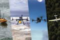
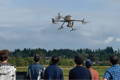
contact@measur.caEmbrace the future of geospatial data collection with our state-of-the-art surveying and mapping drones. In an era where precision matters more than ever, drones allow you to capture data with high accuracy, efficiency, and cost-effectiveness. Measur offers professional mapping drones equipped with advanced GPS and LiDAR technology, ensuring millimeter-level precision in your surveys. From construction site mapping and agriculture to environmental monitoring and infrastructure inspection, our wide range of drone solutions excel in many industries.
Find the perfect solution for your needs.
Reduce the costs associated with traditional surveying methods, such as hiring a surveying team or renting specialized equipment. With our drone solutions you can cover larger areas in less time, resulting in cost savings.

Cover large areas quickly and efficiently, reducing the time and labor required for traditional surveying methods. This efficiency leads to faster data collection and project completion.
Capture high-resolution imagery and 3D models with exceptional accuracy. This precision is essential for tasks like creating detailed topographic maps, monitoring crop health, or inspecting infrastructure, ensuring the quality and reliability of the collected data.

Collect large amounts of data quickly, process and visualize it in 3D models, orthomosaics, and point clouds. This data accessibility allows stakeholders to make informed decisions, plan projects effectively, and gain insights that were previously challenging to obtain.
Efficiency, Precision, and Reliability: Our Expert Recommendations
Flight Time: 45 min
Wind Resistance: 12 m/s
Effective Pixels: 20MP
Flight Time: 55 min
Max Payload: 2.7 kg
Max Flight Altitude: 7000 m
RGB Camera: 45 MP, full frame sensor
Absolute Accuracy: 5 cm horizontal
Shutter Speed: 1/2000 seconds
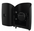
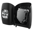
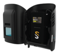
The Trinity Pro UAV is designed for easy and safe handling with a user-friendly remote control and emergency override capabilities. It offers the longest flight time in its class. Additionally, the Trinity Pro comes "ready to fly" in a molded transport case, making it easy to transport to operation areas.
Wind Tolerance: 18m/s
Area Coverage: 700ha
Take-off Altitude: 4800m
Flight Time: 90min
L1/L2 PPK: Integrated Receiver
LiDAR: Integrated Payload
Sony RX1 RII
Resolution: 42.4 MP
GSD: 1.29 cm @100m AGL
Trigger Interval: 1.4 sec
Sony R10C
Resolution: 20.1MP
GSD: 2.66 cm@100m AGL
Trigger Interval: 1.1 sec
Oblique D2M
Total Resolution: 130 MP
GSD: 1.5 cm @100m AGL
Cameras: 1 x NADIR, 4 x oblique
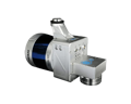
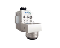
Qube 240
Precision: 1.8 - 2.5 cm cm
Accuracy: < 3 cm
Point density @100m: 50-100 points/m²

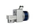
Accuracy: ±3 cm
AGL Altitude: 80m
Weight: 2.0 kg
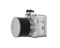
Accuracy: ±5 cm
Channels: 40
Weight: 2 kg
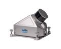
Accuracy: 5 cm
Channels: 16
Weight: 1.4 kg
Accuracy: 5cm
AGL Altitude: 70
Weight: 1.12 kg
Range Accuracy: ±3 cm
AGL Altitude: 90m
Weight: 4.7 kg
Accuracy: 5 cm
Scan Rate: 240,000 pts/s
Weight: 1.1 kg
Accuracy: ±2 cm
Scan Rate: 240,000 pts/s
Weight: 1.25 kg
Accuracy: <10 cm
AGL Altitude:100m
Weight: 5.3 kg
Accuracy: 2.2 cm
AGL Altitude:300m
Weight: 2.6 kg
Accuracy: 3 cm
AGL Altitude: 70m
Weight: 1.5 kg
Accuracy: 5 cm
Max Vehicle Speed: 25-50 km/h
Weight: 5.6 kg
Accuracy: 3 cm
AGL Altitude: 100m
Weight: 1.1 kg
Accuracy: 5 cm
AGL Altitude: 90m
Weight: 1.32 kg
Accuracy: 1 cm
AGL Altitude: 440m
Weight: 3.5 kg
Accuracy: 5 cm
AGL Altitude: 100m
Weight: 2.6 kg
Accuracy: 5 cm
AGL Altitude:100m
Weight: 2.6 kg
Whether you need one-on-one or group training, our training programs provide the latest practical knowledge while keeping your budget in mind.
Looking to rent a drone to meet your evolving drone needs?
You'll find a wide range of industry-leading equipment, from DJI drones to advanced LiDAR systems at Measur. We offer cost-effective and convenient solutions for accessing high-quality drone technology without the commitment of ownership.