[Webinar] ScoutDI: Revolutionizing Confined Space UTM Inspections. Register Now

Call Us: +1 866 300 9012

contact@measur.ca

Call Us: +1 866 300 9012

contact@measur.ca
SHOPPING CART

No Products in the Cart

TOTAL:
$0.00

Optimizing Stockpile Measurements with DJI Enterprise Drones and DJI Terra

Drones have revolutionized various industries, and one area where they have proven to be particularly valuable is in stockpile measurements. With the advanced capabilities of DJI Enterprise Drones and the powerful data processing tool, DJI Terra, optimizing stockpile measurements has become easier and more efficient than ever before. In this article, we will explore the essential steps for accurate results, the hardware options available, the process of creating a mission for optimal data collection, efficient data processing in DJI Terra, and the confidence that comes with analyzing stockpiles. We will also discuss streamlining exporting processes and the possibilities that third-party solutions can bring to enhance capabilities in stockpile measurements.

Maximizing Accuracy with Your DJI Enterprise Drone

Accurate stockpile measurements are essential for a variety of industries, including construction, mining, and agriculture. When it comes to maximizing accuracy, there are several key steps that must be followed.

Essential Steps for Accurate Results

1. First and foremost, it is crucial to ensure that your drone is properly calibrated. This includes calibrating the compass, gimbal, and IMU. Additionally, it is essential to regularly check and update the firmware to ensure optimal performance.

2.Secondly, it is important to carefully plan your mission and collect data in a systematic manner. This means capturing high-resolution images or videos of the stockpile from various angles and altitudes. It is also recommended to have overlapping images to ensure accurate 3D modelling of the stockpile.

3. Lastly, post-processing the data is a vital step in achieving accurate results. By utilizing software like DJI Terra, you can generate highly detailed and accurate 3D models of the stockpile, allowing for precise volume calculations.

Choosing the Right Hardware for Precise Measurements

When it comes to stockpile measurements, the choice of hardware plays a crucial role in achieving accurate results. DJI offers a range of Enterprise Drones specifically designed for industrial applications such as stockpile measurements.

The DJI Matrice 350 RTK, for example, is equipped with advanced flight control systems, high-resolution cameras, and advanced AI capabilities. The RTK (Real-Time Kinematic) positioning system allows for centimeter-level precision, ensuring highly accurate measurements.

The DJI Mavic 3 Enterprise  is another popular choice. It features a high-resolution camera with a mechanical shutter, which reduces the risk of distortion and captures precise and clear images for accurate measurements.
$10,209.00
Additionally, the DJI Matrice 350 RTK drone, equipped with the DJI L2 LiDAR offers precise stockpile measurements through its high vertical (4cm) and horizontal accuracy (5 cm) achieved via integrated GNSS and IMU technology. Its reduced laser spot size and support for up to 5 returns ensure detailed point cloud generation, even in complex surfaces. With an expanded detection range and intuitive user interface, the L2 system facilitates efficient data collection and analysis, making it a comprehensive solution for accurate stockpile volume assessments and inventory management.
$16,659.00

Creating a Mission for Optimal Data Collection

Creating a mission is a crucial step in optimizing stockpile measurements. With DJI Terra, you can easily plan and execute missions to capture the necessary data for accurate measurements.

The software allows you to define the area of interest and set the desired flight parameters, including altitude, speed, and overlap. The intuitive interface makes it easy to plan the mission and ensure complete coverage of the stockpile.

During the mission, the DJI Enterprise Drone will autonomously capture the required images or videos, allowing you to focus on other important aspects of the project.

Efficient Data Processing in DJI Terra

Once the data has been collected, efficient data processing is crucial for generating accurate stockpile measurements. DJI Terra simplifies the data processing workflow, allowing you to transform the captured images or videos into highly detailed 3D models.

Using the software's powerful algorithms, DJI Terra automatically stitches the images together, creating a comprehensive 3D model of the stockpile. The software also allows for the integration of ground control points, further improving the accuracy of the measurements.

With DJI Terra, you can easily visualize the stockpile from different perspectives and conduct accurate volume calculations. The software also provides tools for measuring distances and angles, allowing for a comprehensive analysis of the stockpile.

Analyzing Stockpiles with Confidence

One of the significant advantages of utilizing DJI Enterprise Drones and DJI Terra for stockpile measurements is the confidence that comes with accurate data analysis.

With the highly detailed 3D models generated by DJI Terra, you can analyze the stockpile's volume, shape, and surface area with precision. This enables you to make informed decisions regarding inventory management, resource allocation, and logistics.

By having accurate and up-to-date data, you can optimize your operations and reduce costs by precisely estimating the material required for your projects.

Streamlining Exporting Processes

Exporting the data generated by DJI Terra is a seamless process that allows you to easily share the results with project stakeholders or incorporate them into other software applications.

DJI Terra supports various export formats, including point cloud data, orthomosaic maps, and 3D models in industry-standard formats such as .LAS, .XYZ, .OBJ, and .TIFF. This flexibility enables you to collaborate effectively and integrate the data into your existing workflows or third-party software.

Exploring Third-Party Solutions for Enhanced Capabilities

While DJI Terra provides robust data processing capabilities, there are also various third-party solutions available that can further enhance the capabilities of DJI Enterprise Drones in stockpile measurements.

Some of these solutions offer advanced analytics and reporting features, allowing you to gain deeper insights into the stockpile data. Others provide integration with specialized software applications, enabling seamless workflow integration and automation.

By exploring these third-party solutions, you can unlock additional features and functionalities that cater specifically to your industry's requirements and further optimize your stockpile measurement processes.

Understanding the Concept of Stockpiles

Before delving into the technicalities of stockpile measurements, it is important to understand the concept of stockpiles and why accurate measurements are crucial in various industries.

Stockpiles are accumulations of material or resources stored in a particular location. They can range from minerals and ores in mining operations to construction materials such as sand, gravel, and stones. Agricultural industries also rely on stockpiles for storing crops, seeds, and fertilizers.

Accurate stockpile measurements are necessary for effective inventory management, estimating resource availability, and ensuring compliance with regulations. By utilizing DJI Enterprise Drones and DJI Terra, industries can streamline and optimize their stockpile measurement workflows, leading to improved operational efficiency.

Streamlining Stockpile Measurements with Drones

Drones have transformed stockpile measurements, making them more efficient, accurate, and cost-effective. With traditional methods, stockpile measurements often required manual surveys or ground-based measurements, which were time-consuming, labor-intensive, and prone to errors.

By leveraging the capabilities of DJI Enterprise Drones, industries can streamline their stockpile measurement processes. These drones can capture high-resolution images or videos of the stockpiles from various angles and altitudes, providing detailed visual data for accurate measurements.

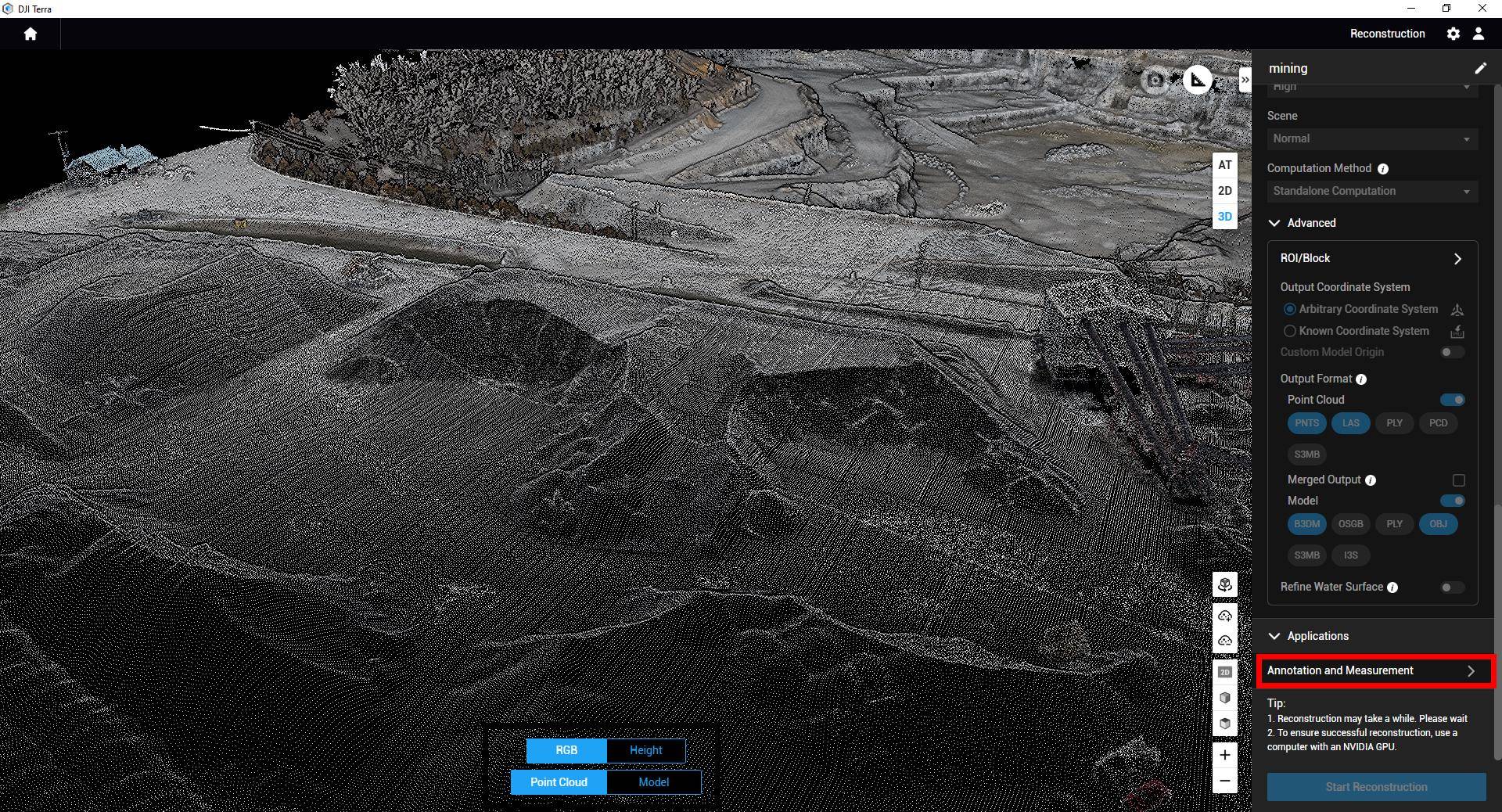
In addition to capturing visual data, DJI Enterprise Drones equipped with LiDAR technology can also capture point cloud data, allowing for even more precise and detailed measurements. LiDAR enables the drones to measure distances and accurately map the stockpile's surface, regardless of its complex shape or vegetation cover.

By eliminating the need for manual measurements, drones significantly reduce the time and resources required for stockpile measurements while improving the accuracy and efficiency of the process.

Unlocking the Potential of Drone Stockpile Measurement Workflow

Incorporating drones into the stockpile measurement process offers a multitude of advantages to various industries. It facilitates regular and punctual measurements, ensuring precise and current data for inventory management and resource planning.

Additionally, utilizing drones obviates the necessity for personnel to physically access the stockpiles, thereby diminishing health and safety hazards. Drones can access remote locations, providing visual data that would otherwise be challenging or unsafe to gather.

Drone-assisted stockpile measurements expedite data collection and analysis. The captured data can be swiftly processed and translated into actionable insights, enabling more informed decision-making and streamlined project execution.

Integrating drones into stockpile measurements results in substantial time and cost savings, enhanced safety measures, and increased operational efficiency.

RELATED POSTS

[WEBINAR REWIND] How Suncor Utilizes Drones to Manage one of Canada’s Largest Drone Programs with Measur and Flight Insight
In the ever-evolving landscape of technological innovation, industries are constantly seeking new ways to enhance efficiency, safety, and environmental responsibility....
The Ultimate Guide to Ground Penetrating Radar (GPR)
Ground Penetrating Radar (GPR) is a geophysical technique that uses electromagnetic waves to create subsurface images and detect objects buried...
The Importance of Indoor Drone Inspections with Scout 137
Traditional methods of confined space inspections often involve sending human inspectors into hazardous environments. However, with the advancement of technology,...

Get in touch

Give us a call or drop by anytime, we will answer all enquiries within 24 hours on business days. We will be happy to answer your questions.

Contact Information

We would love to hear from you! Our team is always here to help.

  • +1 866 300 9012

  • contact@measur.ca

  • Vancouver, British Columbia

    Calgary, Alberta

    Mississauga, Ontario

    Montreal, Quebec

Name*:

Phone*:

Email*:

Message:

BACK TO TOP