FREE WEBINAR: Discover the Complete Trinity Pro Workflow. Date: March 28, 2024. Time: 8 am MDT. Register Now

Call Us: +1 866 300 9012

contact@measur.ca

Call Us: +1 866 300 9012

contact@measur.ca
SHOPPING CART

No Products in the Cart

TOTAL:
$0.00
GreenValley LiAir X3C-H

    GreenValley LiAir X3C-H

    $0.00

    The LiAir X3C-H is a newly launched compact, high-performance UAV LiDAR system that is an upgrade to GreenValley International's LiAir300. It features a new integrated design style and a built-in high-resolution mapping camera, which improves its performance and usability for various applications like power-line inspection, topographic surveying, and agricultural and forest monitoring.

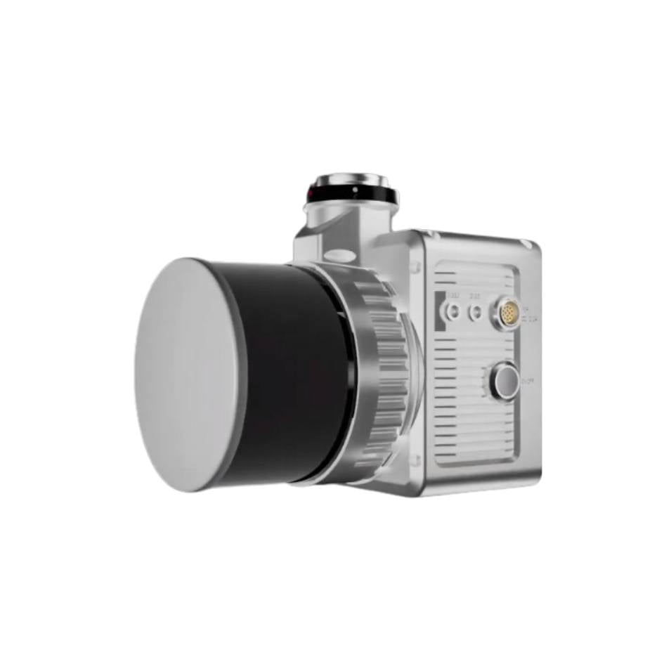
    The LiAir X3C-H has a compact and user-friendly operation interface, with an unpluggable TF Card and a data storage model that allows for one-touch operation and copying of laser and camera data, making it more convenient to use.

    The system's built-in high-resolution mapping camera has been upgraded to 26 megapixels, providing ultra-clear picture quality and enabling the creation of high-quality true-colour point clouds and orthophotos for photogrammetry. Moreover, the LiAir X3C-H has an external camera interface that permits simultaneous mounting of infrared cameras and other camera types, making it a versatile tool for different applications.


    GreenValley International Data

    Triple Return

    1,920,000 pts/sec


    Detection Range

    300m (reflectance ≥ 90%)


    Weight

    1.12 kg


    FOV

    360° (Horizontal) ×40.3° (Vertical)


    Specifications

    System Parameters

    Detection Range: 80m (reflectance ≥ 10%) | 200m (reflectance ≥ 54%) | 300m (reflectance ≥ 90%)
    Weight: 1.12 kg
    Voltage: 12-24V
    Operating Temperature: -20-50°C
    Communication: WIFI


    LiDAR Unit


    Wavelenght: 905 nm
    Laser Frequency: First Return: 640,000 points/s Dual Return: 1,280,000 points/s Triple Return: 1,920,000 points/s


    Intertial Navigation System


    GNSS: GPS,GLONASS,BeiDou
    Attitude Accuracy: 0.008°


    Camera


    Pixels: 26 MP
    Focal Length: 16mm/24mm (Equiv.Focal Length)


    Software


    Pre-processing: LiGeoreference


    Accuracy (Vertical): 5cm@70m
    Typical rec.Collection Speed: 5-10m/s
    Memory: 256G TF Card
    Power Consumption: 24W
    Storage Temperature: -30-60°C


    Number of Channels: 32
    FOV: 360° (Horizontal) × 40.3° (Vertical)
    Number of Returns: 3


    Azimuth Accurac: 0.038°
    Data Frequency: 200HZ


    Image Size: 6252 x 4168


    Post-processing: LiDAR360/LiPowerline (Optional)

    BACK TO TOP