No Products in the Cart


|
Flight Time (max) |
Payload Weight Up To |
Motors |
Autopilot |
175 Minutes
|
6 kg |
6 Ace |
Orange or Blue Cube |
These flight times are representations of the typical flight time in normal conditions and are depending on several factors.

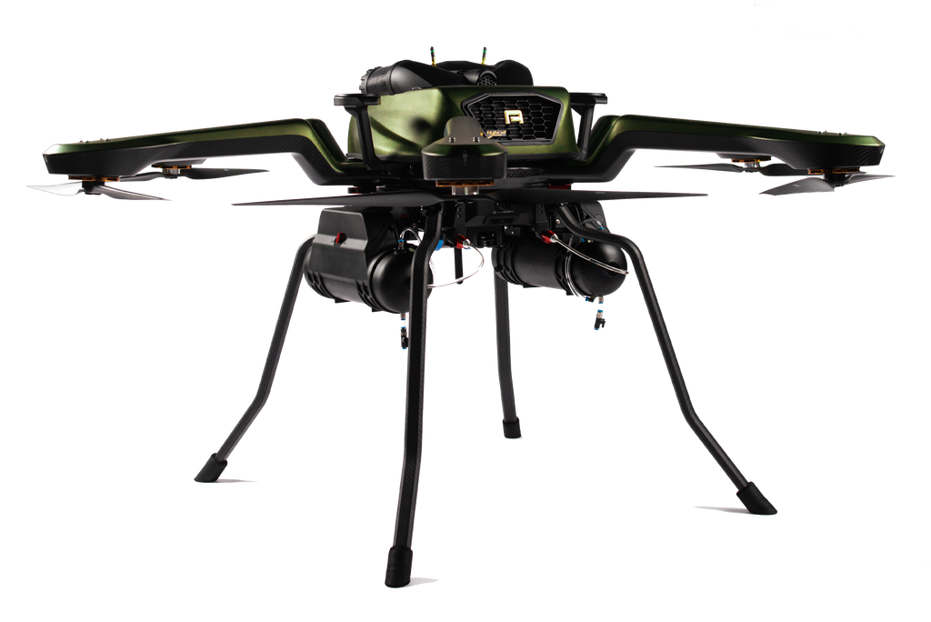
Noa Hybrid SpecsMotors: Direct Drive 3-phase BLDC out runner Flight Time: Max 175 minutes Payload Weight: Max. 6 kg Autopilot: Cube MTOW: 31 kg/ 68.3 lbs Datalink Range: 16 km Power: Hybrid gas-electric |
 |
The Noa Hybrid offers additional redundancies to cover for any unexpected events – both its detachable fuel tanks contain independent backup batteries that can land the drone safely if the main power cuts out. Just as with the electric Noa, the Hybrid is able to lose one of its propellers/ motors and still land safely. Land surveying, 2D & 3D LiDAR mapping, wind turbine/ powerline inspection and a wide array of professions will find the extended endurance especially useful, covering more ground in a day than ever before.
Noa Hybrid’s excellent flight performance, endurance, and internally stabilized quick release make it a workhorse for LiDAR applications. It is capable of laser-guided terrain following and has a retractable landing gear for a 360 degrees unobstructed field of view. Noa’s generous payload capacity allows users to configure it with the highest spec LiDAR systems reaching accuracies up to 10mm with photo-realistically colored point clouds. Try it with the entire YellowScan series of LiDAR payloads.
Acecore Noa Hybrid offers both civil and military grade operator setups with compliant datalinks. The standard remote, George Herelink, features 10km range and an optional tablet mount to use the Surface Go tablet as mission control centre. Alternatively the Acecore UXV Micronav is available with a Doodle Labs smart radio or Persistent Systems MPU5 to support STANAG 4609 stream
Custom IntegrationsAcecore offers many of today’s most advanced payloads and setups as off-the-shelf products, but anything is possible with their engineering team! Acecore builds commercial UAV's to whatever spec and application that the customer is looking for.
|
 |
|
Full Camera Control Take full control of Sony, Workswell, Phase One, and other camera's while airborne
|
Mapping Module Automatically geotags images from integrated cameras with GPS data from the drone's system.  |
FPV Package Digital First-Person-View camera for pilot orientation.  |
|
Herelink George All-in-one datalink for UAV control, payload control and mission planning >5km range.
|
FrSky George 16-channel remote for UAV control >30km, optional monitor and video links.  |
Dual Operator Adds dedicated Ground Station pro for payload operation and mission planning.  |


