No Products in the Cart
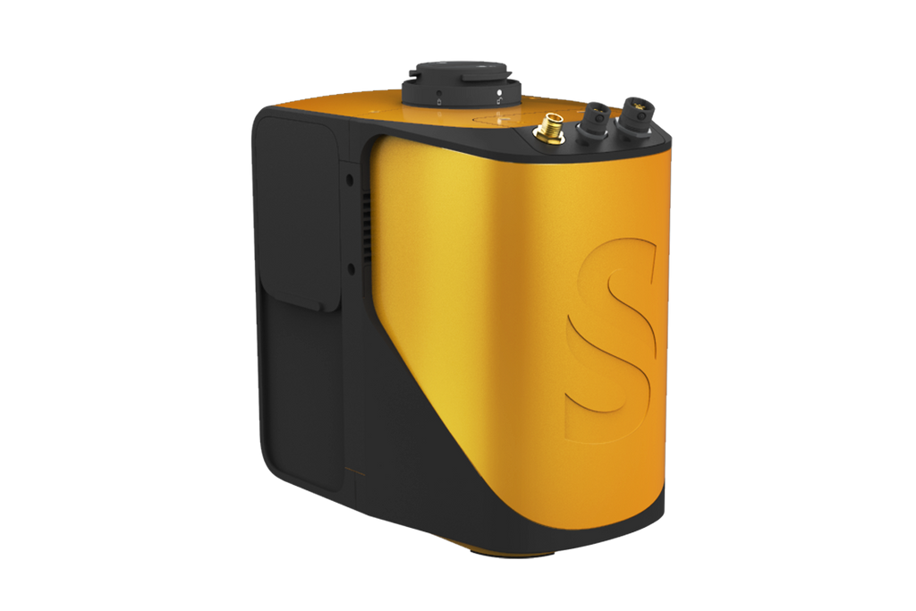


Livox Based LiDAR System
YellowScan Mapper UAV LiDAR system is equipped with a high-performance Livox Horizon laser scanner from Livox, a DJI-backed company. With a great point density, this LiDAR sensor allows our LiDAR system to fly easily at 70m AGL with a 120m swath.
We recommend a balanced 10 m/s flight speed to benefit from Mapper point density while having good productivity. For example, flying at 70m AGL, 10 m/s, you will be able to map 10 ha in 3 minutes.
YellowScan Mapper is definitely the right LiDAR tool to start with. Your data collection will be fast, accurate and cost-effective.
Connect your Mapper LiDAR system to your DJI Skyport.Designed for seamless integration with various UAVs including multirotor and fixed-wing drones. The integration options of Gremsy and DJI skyport, along with the custom mounting bracket, ensure a quick and convenient setup for rapid mapping operations.
|
|

 |
 |
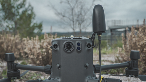
High-quality GPS antennaThe GNSS antenna provided is able to receive superior signal from GPS L1/L2/L5/L-band, GLONASS G1/G2/G3, BDS B1/B2/B3, Galileo E5a/E5b/E6/E1. It has IP-67 protection from dust and water and a low wind-resistance design. High-quality GPS antenna is a must to get high-quality georeferenced point cloud. You deserve it. |
IP55 protectionYellowScan Mapper has IPW55 protection meaning rain is not an issue during data collection: you have time to land. You can start your flight without rain in a weather that “might forecasts rain”. If during the flight it starts raining, there is no issue flying back home. Your LiDAR is safe. The LiDAR system is equipped with non-slip rubber pads. You can lay your system down without fearing to damage it. |
 |
 |
Easily carry your mapping solution with a backpack!Let’s take advantage of this compact and lightweight LiDAR system. This time we thought it would be good having a backpack. In this hardshell backpack with custom precut foam, you easily carry your LiDAR with everything you need (LiDAR system, software, batteries, laptop, data storage). This backpack has carry-on size to fit in any airline overhead compartment. |
Don’t miss anything before going back to the office with Live Data transmission.In-flight LiDAR Data transmission is enabled by a dedicated port. The YellowScan Mapper is compatible with LiveStation, allowing live visualization of LiDAR data collection. Your mission has to be a success. |