[Webinar] ScoutDI: Revolutionizing Confined Space UTM Inspections. Register Now

Call Us: +1 866 300 9012

contact@measur.ca

Call Us: +1 866 300 9012

contact@measur.ca
SHOPPING CART

No Products in the Cart

TOTAL:
$0.00

Exploring the Depths with Blueye Underwater Drones

Thanks to advancements in technology, exploring the depths has become more accessible than ever before. With the emergence of underwater ROVs (Remotely Operated Vehicles), what was once a distant dream is now within reach.  Whether you're a marine researcher or an underwater archaeologist, these revolutionary machines are making waves, literally! In this article, we'll explore Blueye underwater drones, the technology driving them, and examine their myriad of applications.

Understanding the Basics of an Underwater Drone ROV

What is an Underwater Drone or ROV?

An underwater drone or ROV is a remotely operated vehicle designed for exploration and data collection in underwater environments. It serves as an extension of human eyes and hands, allowing us to explore underwater depths that are too dangerous or inaccessible for divers. By utilizing cameras, sensors, and mechanical arms, these drones can capture images, videos, and even collect samples from the depths of the ocean. They are designed to be pressure-resistant, corrosion-resistant, and durable to ensure they can operate effectively in challenging underwater environments.

Key Components of an Underwater Drone

Underwater drones are equipped with several key components that enable them to perform their tasks effectively including a sturdy frame, buoyancy modules, high-resolution cameras, powerful thrusters for maneuverability, a control and communication system, and a manipulator arm for interacting with the environment. These components work in harmony to provide control, stability, and functionality to the underwater ROVs.

The high-resolution cameras mounted on underwater drones are essential for capturing clear images and videos of the underwater environment. These cameras are equipped with advanced imaging technology that allows them to operate in low light conditions and capture high-quality footage even in murky waters. This visual data is crucial for researchers, scientists, and explorers to study marine life, underwater ecosystems, and geological formations.

The Technology Behind Underwater Drones

Underwater drones, also known as ROVs, rely on a sophisticated array of technologies to navigate the challenging underwater environments they explore. These drones are equipped with state-of-the-art navigation systems that enable them to move with precision and accuracy beneath the waves.

Navigation Systems

The ability to navigate accurately in complex underwater environments is crucial for underwater drones. To achieve this, these drones employ a combination of inertial navigation systems, depth sensors, and acoustic positioning technologies. By integrating these systems, underwater drones can determine their precise position, orientation, and depth, enabling them to navigate through tight spaces and follow pre-planned routes with precision.

Inertial navigation systems utilize sensors to measure the drone's acceleration and rotation rates, providing crucial data for calculating its position and orientation in three-dimensional space. Depth sensors, on the other hand, allow the drone to determine its depth below the surface, essential for avoiding obstacles and maintaining safe operating depths. Acoustic positioning technologies further enhance navigation by using sound waves to communicate with surface vessels or other drones, enabling precise positioning even in challenging underwater conditions.

Imaging and Data Collection in Underwater Drones

One of the primary purposes of underwater drones is to capture high-quality images and collect valuable data from the underwater world. Equipped with advanced imaging systems, including high-resolution cameras and sonar technology, these drones can capture detailed images and create accurate maps of the underwater terrain. Additionally, they can gather environmental data such as temperature, conductivity, and salinity, providing researchers with valuable insights into the underwater ecosystem.

Sonar technology plays a critical role in imaging and data collection for underwater drones. By emitting sound waves and analyzing the echoes that bounce back, these drones can create detailed maps of the seafloor and detect underwater objects with precision. This capability is particularly useful for conducting underwater surveys, locating shipwrecks, or monitoring marine life without disturbing their natural habitat.

Applications of Underwater Drone ROVs

Marine Research and Exploration

Underwater drone ROVs have become invaluable tools for marine researchers and scientists. These drones enable them to study marine life, investigate underwater habitats, and monitor environmental changes in real-time. Through underwater drones, researchers can collect data over extended periods and access remote locations, ultimately advancing our understanding of the oceans and their fragile ecosystems.

Underwater Archaeology and Treasure Hunting

In the realm of archaeology and treasure hunting, underwater drone ROVs have revolutionized the way we explore submerged historical sites and search for lost treasures. With their ability to navigate tight spaces and capture high-resolution images, these drones assist archaeologists in documenting and preserving underwater artifacts. Moreover, underwater drones equipped with metal detectors and robotic arms can aid in the recovery of long-lost treasures, making exploration more efficient and cost-effective.

Expanding the Use of Underwater Drones in Various Fields

As the technology continues to evolve, the applications of underwater drones are expected to expand further into various fields. From offshore industries and environmental monitoring to search and rescue missions and pipeline inspections, the versatility of these drones makes them indispensable in solving complex challenges both below and above the water.

Blueye Underwater Drones

Blueye offers a range of cutting-edge underwater exploration solutions designed to revolutionize how we observe and interact with the underwater world. Among their offerings are the Blueye Pioneer, Blueye X1, and Blueye X3, each tailored to meet different needs and requirements. In this comparison, we'll explore the features, capabilities, and specifications of each drone to help you understand their differences and choose the one that best fits your underwater exploration needs.
Below is a comparison between the Blueye Pioneer, Blueye X1 and X3 underwater drones:

Depth Rating


Blueye Pioneer: Rated for depths of up to 150 meters (500 feet).

Blueye X1 and X3: Both rated for depths of up to 305 meters (1000 feet).

Capability and Flexibility


Blueye Pioneer: Designed to provide exceptional user experience and performance with features such as a full HD camera, powerful LED lights, and a thin tether. Suitable for solo operations and transportation by one person. However, it lacks the extensive customization options and integration capabilities of the X3.

Blueye X1: Primarily designed for quick and user-friendly inspections with a focus on inspection capabilities. It features a mechanical tilt camera and is suitable for one-man portable operations.

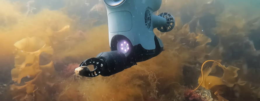
Blueye X3: Offers extensive customization options and integration capabilities with three guest ports. It can integrate various external equipment such as grippers, external lights, cameras, sonars, and sensors, making it suitable for more complex underwater tasks.

Battery Life


Blueye Pioneer: Replaceable battery with a runtime of up to 5 hours.

Blueye X1: Replaceable battery with a runtime of up to 5 hours.

Blueye X3: Runtime of up to 2 hours on standard battery and up to 5 hours on high-capacity battery.

Camera Specifications


Blueye Pioneer: CMOS sensor with a maximum image size of 1920 x 1080 pixels and a 64 GB SD card for video storage.

Blueye X1 and X3: Exmor R CMOS sensor with a maximum image size of 1920 x 1080 pixels and a 256 GB SD card for video storage.

RELATED POSTS

[WEBINAR REWIND] How Suncor Utilizes Drones to Manage one of Canada’s Largest Drone Programs with Measur and Flight Insight
In the ever-evolving landscape of technological innovation, industries are constantly seeking new ways to enhance efficiency, safety, and environmental responsibility....
The Ultimate Guide to Ground Penetrating Radar (GPR)
Ground Penetrating Radar (GPR) is a geophysical technique that uses electromagnetic waves to create subsurface images and detect objects buried...
The Importance of Indoor Drone Inspections with Scout 137
Traditional methods of confined space inspections often involve sending human inspectors into hazardous environments. However, with the advancement of technology,...

Get in touch

Give us a call or drop by anytime, we will answer all enquiries within 24 hours on business days. We will be happy to answer your questions.

Contact Information

We would love to hear from you! Our team is always here to help.

  • +1 866 300 9012

  • contact@measur.ca

  • Vancouver, British Columbia

    Calgary, Alberta

    Mississauga, Ontario

    Montreal, Quebec

Name*:

Phone*:

Email*:

Message:

BACK TO TOP