No Products in the Cart
LiDAR technology has been a game-changer in the world of mapping and surveying, providing highly accurate and detailed 3D data for various applications, from urban planning to environmental monitoring. YellowScan, a leading provider of LiDAR solutions, has recently introduced the upgrade of two groundbreaking products: the YellowScan Surveyor Ultra and the YellowScan Explorer. These cutting-edge aerial LiDAR systems offer exceptional performance and versatility, making them ideal for a wide range of mapping and surveying projects.
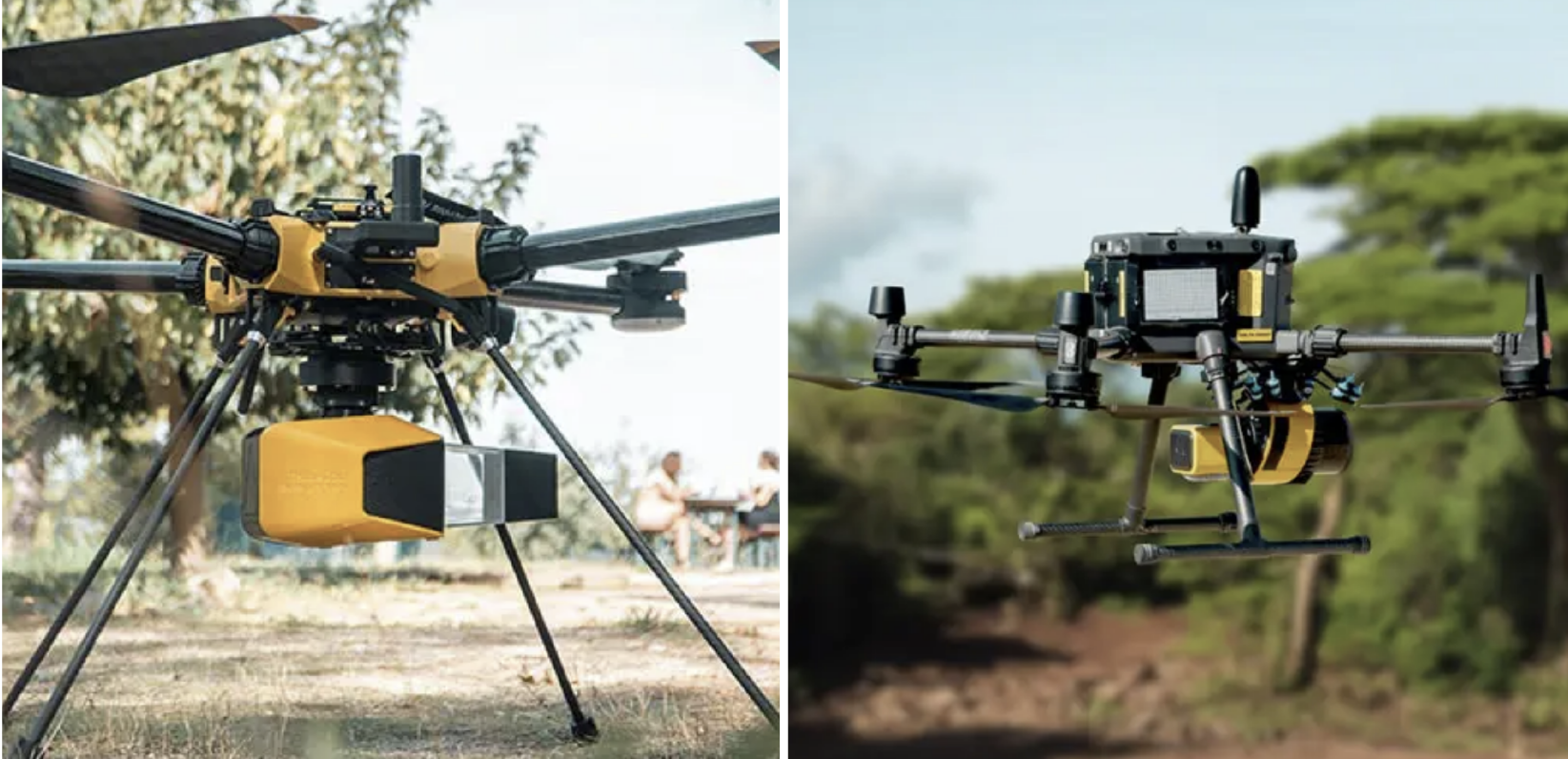
In the dynamic world of LiDAR technology, the YellowScan Surveyor Ultra stands out as a beacon of adaptability and innovation. This advanced LiDAR system has the potential to transform your mapping and surveying projects, offering an extensive set of features that cater to the most demanding requirements of today's professionals.
Key Specifications:
Typical Flying Height: 100m AGL (Above Ground Level)
System Precision: 3cm
System Accuracy: 2.5cm
Battery Weight (Excluding): 983g
1. Unmatched Versatility: This LiDAR system can be effortlessly integrated into a variety of UAV platforms, including multirotors, fixed-wing VTOL (Vertical Takeoff and Landing), and helicopter UAVs. This adaptability is a significant asset when dealing with a diverse range of missions, encompassing different sizes and terrains. For instance, you can employ fixed-wing VTOL drones for large-scale surveys and multirotor UAVs for smaller areas or vertical sections. The quick-release attachment mechanism ensures easy mounting on a wide range of drones, providing you with flexibility and convenience.
2. Advanced Accessories: The YellowScan Surveyor Ultra offers a range of optional add-ons to enhance your productivity and simplify your workflow. These modules include terrain, colourization, and strip adjustment options, allowing you to tailor your LiDAR system to your project's specific needs.
3. Streamlined Data Processing: YellowScan doesn't just provide you with the hardware; they offer an all-in-one software solution to handle your LiDAR data efficiently. This software allows you to extract, process, and display data immediately after flight acquisition, streamlining your data processing pipeline.
4. Vertical Mapping-Ready: The Surveyor Ultra stands out with its 360° field of view, making it capable of collecting LiDAR data not only from the ground but also from vertical surfaces. This capability is particularly valuable for applications such as vertical inspections of buildings, bridges, coastal erosion, cliffs, and mountains.
5. User-Friendly Operation: The Surveyor Ultra is designed for 3D modelling under vegetation, ensuring fast and efficient data processing. It is known for its simplicity, making it accessible to both newcomers and experienced professionals in the field.
6. Integrated Camera for Enhanced Data: The Surveyor Ultra goes a step further by featuring an embedded camera with global shutter technology. This camera can be used for colourization purposes, providing an additional layer of visual data to complement the LiDAR information.
7. LiDAR and RGB Data Collection: It offers compatibility with optional single-camera modules, with 20MP or 60MP options, as well as a 35MP dual-camera module. This enables you to collect both LiDAR and high-resolution RGB (Red, Green, Blue) data, enriching the depth and quality of your mapping and surveying projects.
The key features of the YellowScan Explorer that make it a game-changer in the world of LiDAR mapping are as follows:
1. Exceptional Precision: The YellowScan Explorer boasts a precision of 2 cm and an accuracy level that matches this, ensuring the collection of highly detailed and supremely accurate data for mapping and surveying applications. This level of precision is crucial when it comes to tasks where every centimeter matters.
2. Extended Flight Range: With the capability to operate at altitudes of up to 120 meters and a wide range of flight speeds, spanning from 5 to 35 meters per second, the Explorer is tailor-made for efficiently covering vast areas. Whether you're mapping large swaths of land or surveying expansive regions, the Explorer has you covered.
3. User-Friendly Data Collection: The YellowScan Explorer takes user-friendliness to a whole new level with its intuitive interface, front-facing LCD touch screen, and the convenience of two USB sticks for data collection. The ability to store LiDAR data for up to 6 hours with a single USB stick ensures that you can maximize productivity without interruptions.
4. Optimal Temperature Management: Operating under extreme temperature conditions is often a requirement in the world of mapping and surveying. The Explorer has taken this into account with an innovative temperature management system, allowing it to function seamlessly in a wide temperature range, from -20°C to +40°C. You can rely on this LiDAR system to perform consistently under various environmental conditions.
5. Integrated Camera for Enhanced Insights: In line with modern LiDAR technology, the YellowScan Explorer is equipped with an integrated camera featuring a global shutter. This camera is an invaluable asset for colourization purposes, providing a visual layer to complement the LiDAR data, enhancing the quality and insights derived from the collected information.