No Products in the Cart

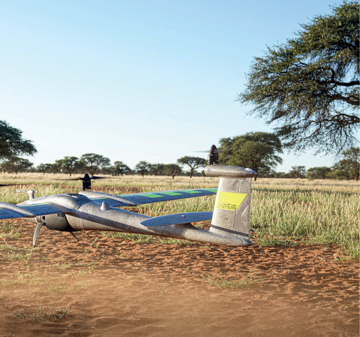
The Trinity Pro is a state-of-the-art mapping drone that boasts cutting-edge technology, including the powerful Quantum-Skynode autopilot and a Linux mission computer. With increased internal storage and connectivity capabilities, Trinity Pro can seamlessly integrate with advanced cameras, logging systems, simulation software, and artificial intelligence tools. With Trinity Pro, mapping and surveying tasks are easier, safer, and more efficient than ever before.
18m/s
Wind Tolerance
700ha
Area Coverage
4800m
Take-off Altitude
90min
Flight Time
Together, the Trinity Pro and QBase 3D deliver a seamless, powerful solution for mapping and surveying tasks, providing precise data with ease and efficiency.
The Quantum-Skynode flight control stack a key component of the Trinity Pro, ensures that the UAV operates in the safest manner possible. With features such as automatic self-diagnostics, terrain awareness, wind simulation, and AI-powered "return to home," operators can rest assured that the Trinity Pro is always in control, even in challenging conditions.
Trinity Pro Technical advances include an enhanced terrain-following system, which significantly improves safety during operations. Additionally, improvements to trigger point calculations results in improved image overlap and higher data quality. Trinity Pro also features automatic wind simulation for crash avoidance in bad weather and a linear approach for landing. Furthermore, Trinity Pro is equipped with a downfacing LiDAR scanner that provides highly accurate ground avoidance and landing control.
A push of a button is enough and the UAV will do its assigned job. The remote control has a clean layout without confusing switches and levers. The Trinity Pro and the remote controller work together seamlessly to get your job done automatically, while still providing emergency override capabilities.
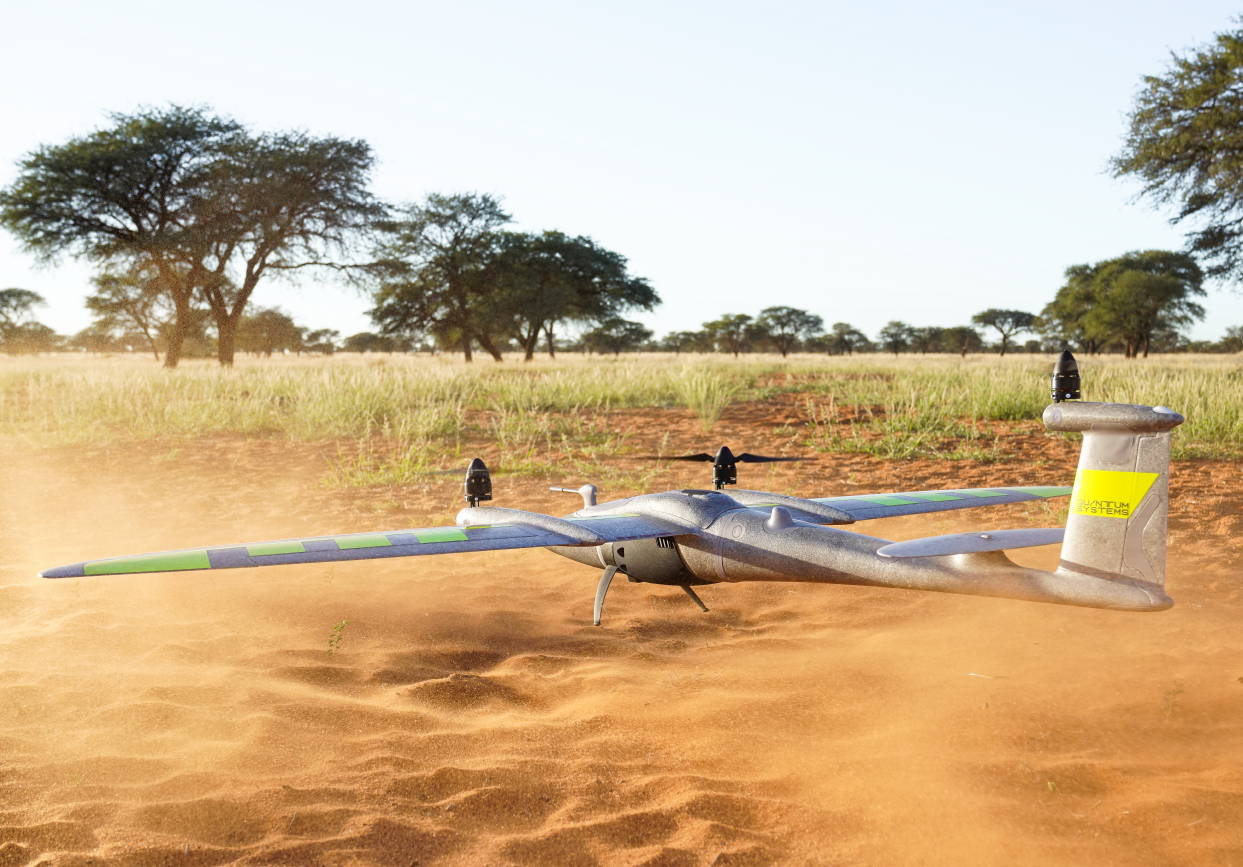
Thanks to Quantum’s sophisticated electric VTOL design your investment is never in danger due to a flawed hand launch or a rough belly landing.
Quantum Systems designed the Trinity Pro to meet the requirements of professionals.
You can see the result in every detail, such as the optimized electric layout, the efficient cargo container or the clean finish of the outer shell. It truly showcases the best of German engineering.
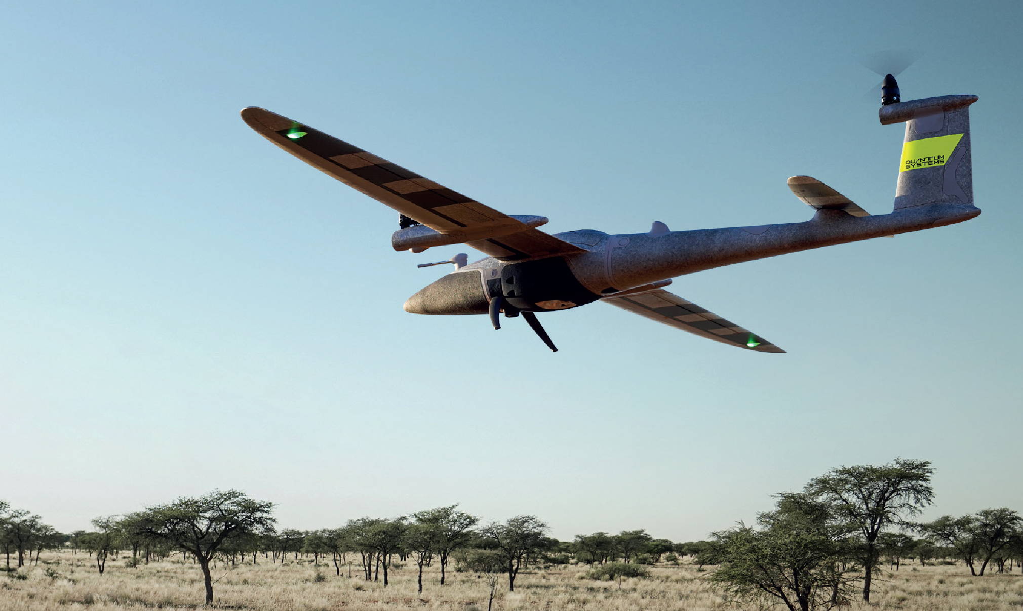
The ability to switch to gliding mode enables the Trinity Pro to directly benefit from an enhanced long range capability. Many hours were dedicated to optimize the wing geometry to push the glide ratio to an outstanding 14:1.
Using only one specially-designed motor in the rear fuselage increases the flight time far beyond current industrial UAVs by reducing energy consumption to a minimum.
The Trinity Pro comes “ready to fly” (RTF) in a molded transport case which offers enough space for the whole package with room to add two optional battery packs, accessories, and a tablet PC.
A padded cover with convenient carrying options makes it easy to transport the package to the farthest operation area. At a size of 100x83x27cm it can be stowed away easily.


Up To
45
MP Camera
Down To
1
Centimeter Absolute
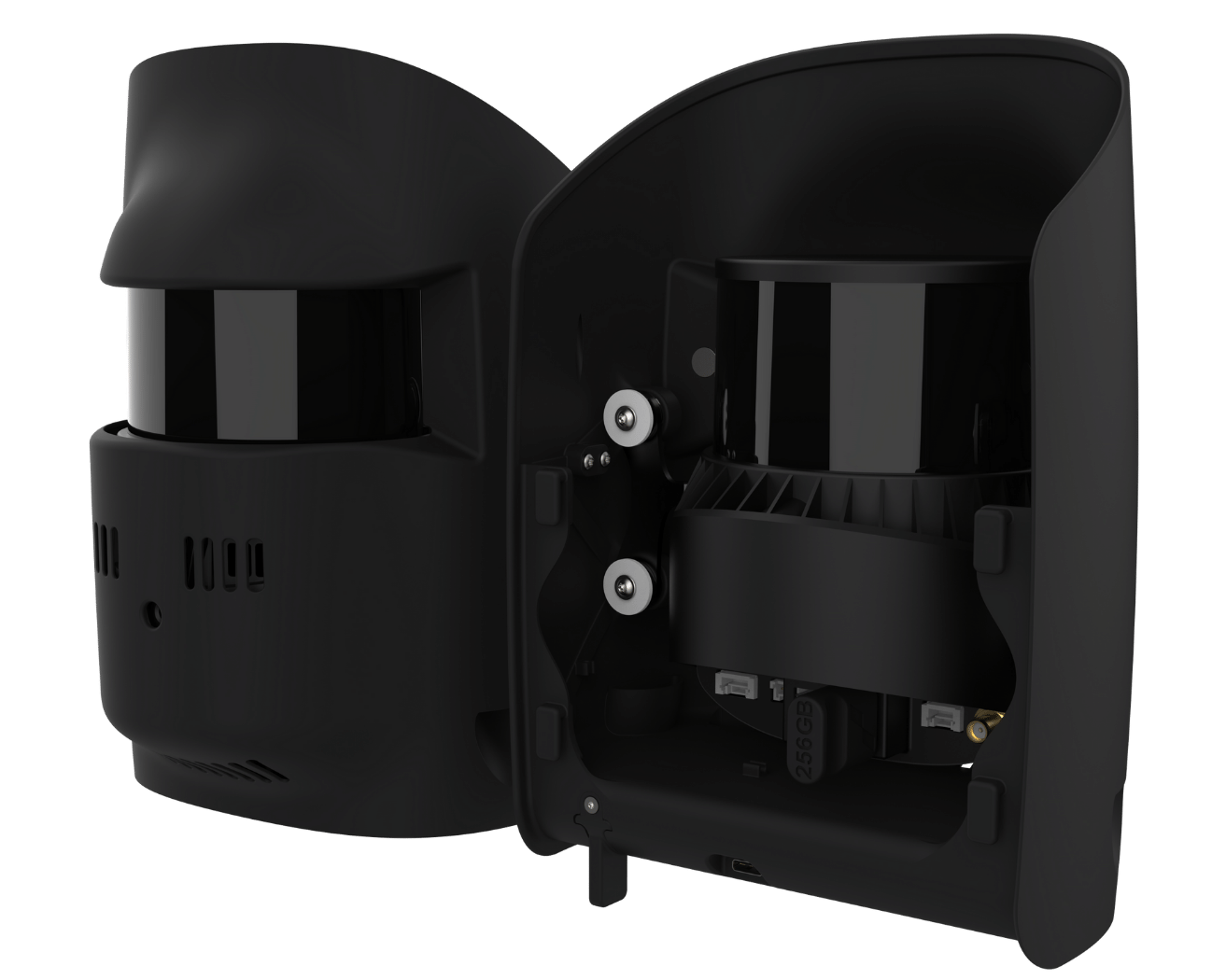
LiDAR
Integrated Payload
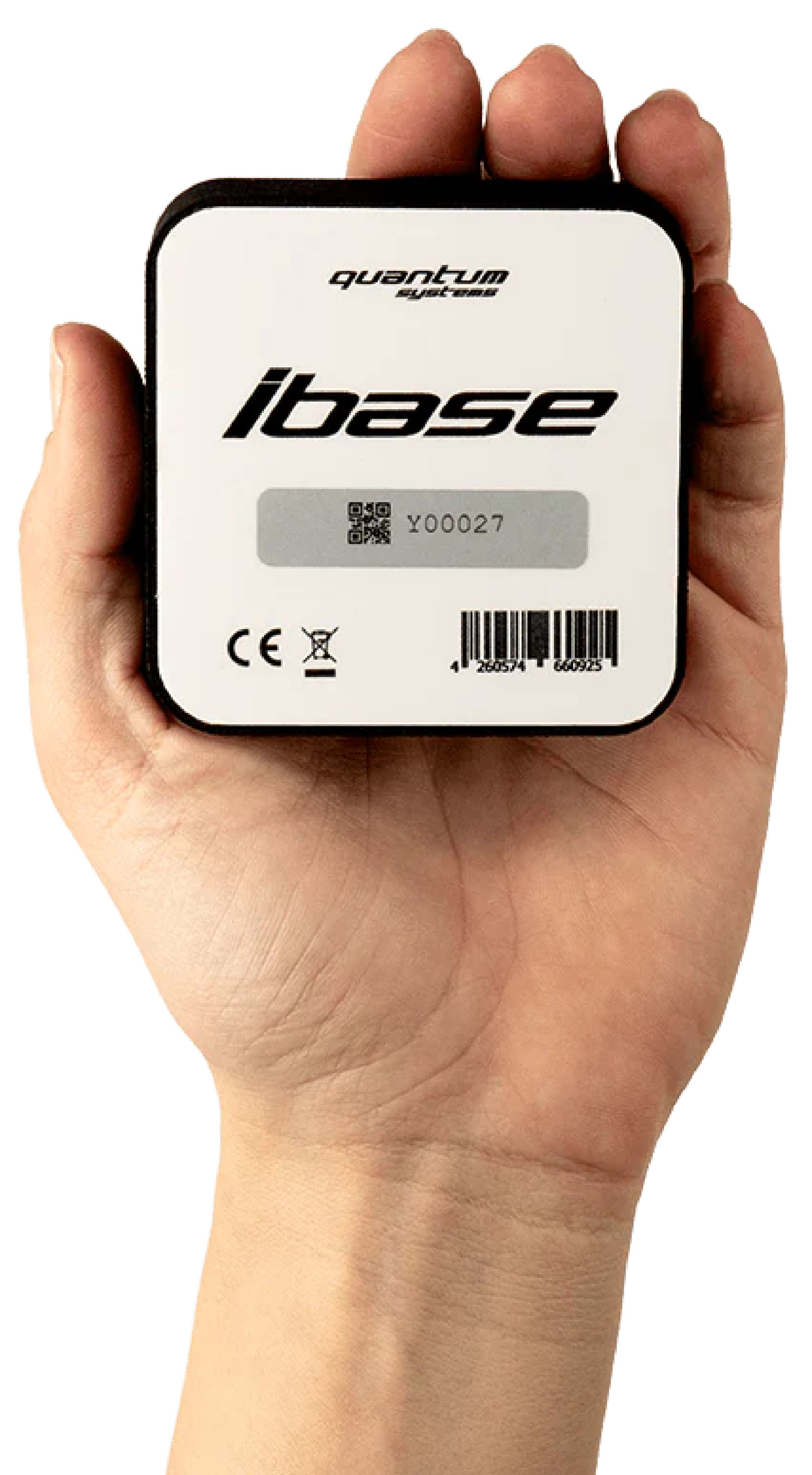
L1/L2
PPK
Integrated Receiver
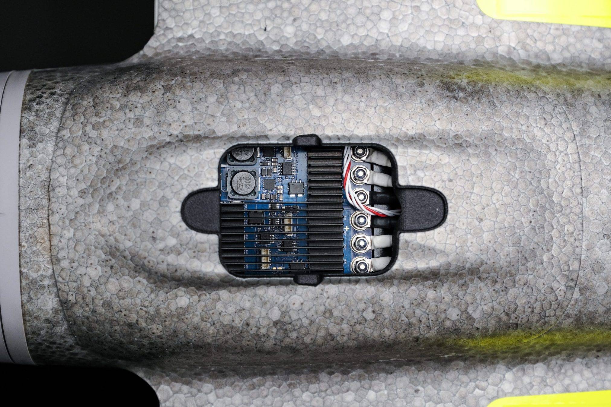
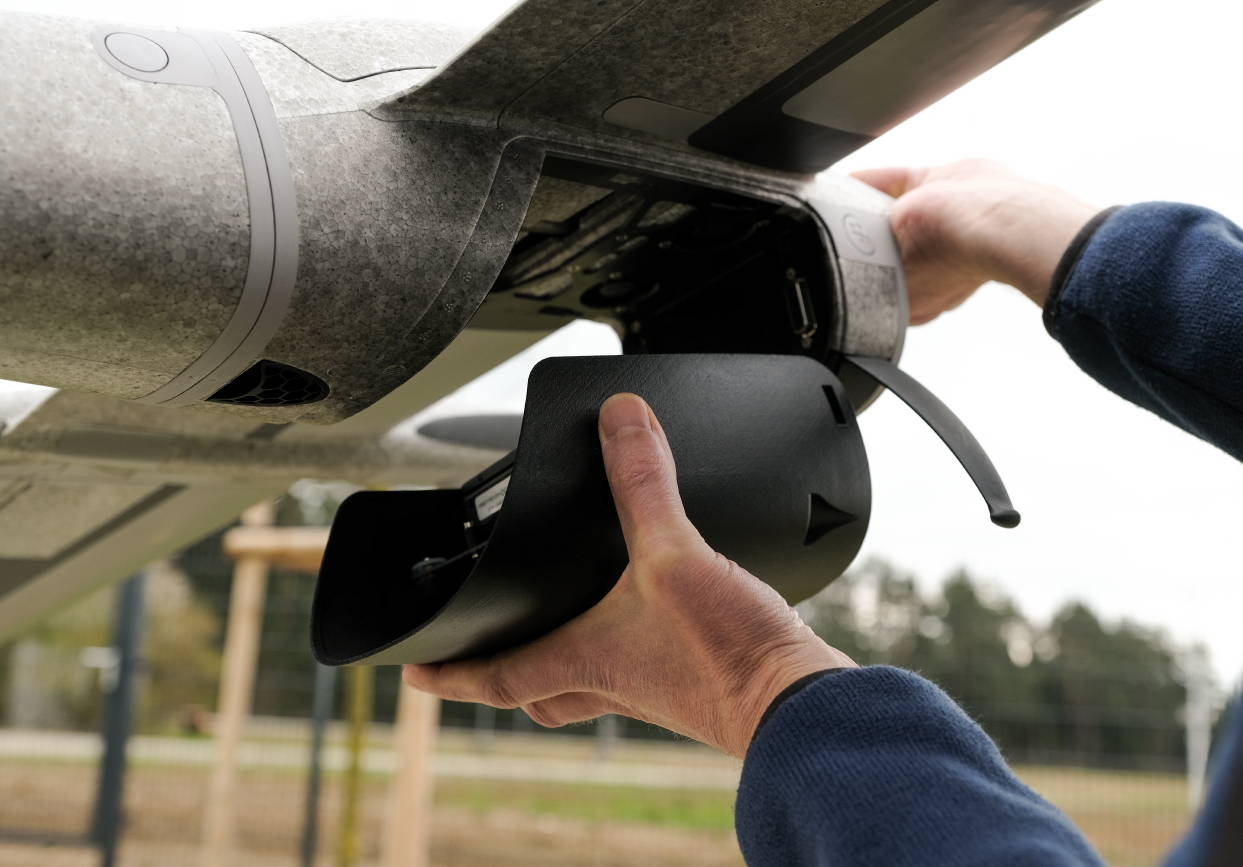
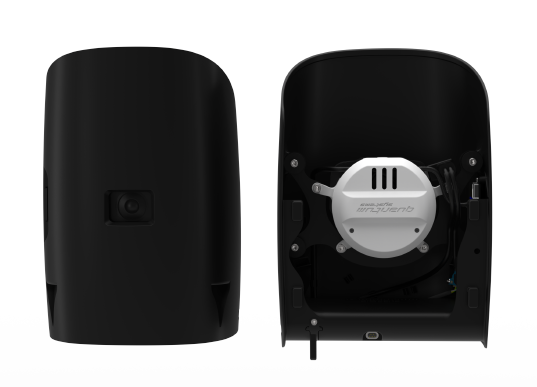
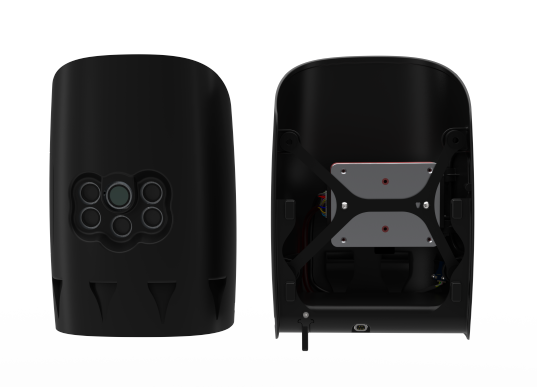
Payloads can easily be swapped in seconds by using the QuickLock mechanism. No tools are required and the sensors are highly integrated to support the pilots’ mission planning.
All cameras are damped against in-flight vibrations to guarantee highest image quality.
Rough landings should be avoided at any time. We rely on vertical take-off and landing to guarantee smooth landings and therefore a long service life. The landing gear keeps your payload safe.
Access to the recorded data is uncomplicated via external card slots.
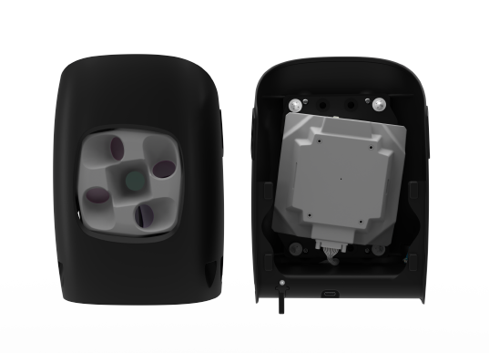
4 oblique and one NADIR camera
APS-C 20.1 MP camera
5 spectral band sensor
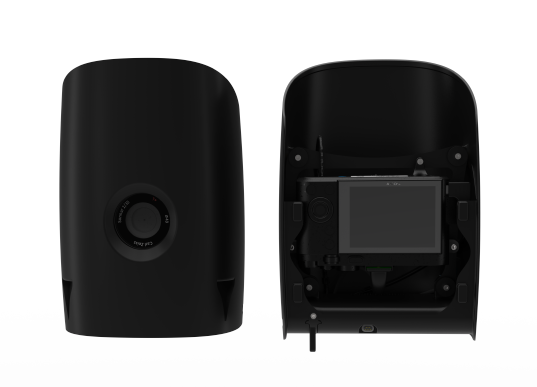
Full-frame 42 MP camera
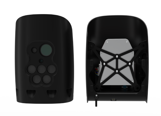
5 spectral bands & thermal sensor
The Qube 640 LiDAR is a survey-grade payload for the Trinity Pro enabling over an hour of flight-time.
*Precision, also called reproducibility or repeatability, accounts for the variation in successive measurements taken on the same target. Depends on altitude AGL.
**Accuracy is the degree of conformity of a measured position to its actual (true) value