No Products in the Cart

Written by: Maria Zavarce
Contributor: Lukas Wilgosh
Created on: August 2, 2023
Last updated: November 19, 2024
8 minutes read
TABLE OF CONTENTS
Define the Purpose of Your Drone Missions
Evaluate Weight and Compatibility with Your Drone
Understand LiDAR Range and Its Impact on Coverage
Balance Accuracy and Precision with Your Budget
Ensure Seamless Integration with Your Drone System
Leverage GNSS for Accurate Georeferencing
Field of View (FOV) for Your Application
RGB and LiDAR Data for Enhanced Insights
Utilize Multiple Returns for Complex Environments
Plan for Data Output and Processing Needs
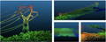
It is no surprise that drones equipped with LiDAR systems have the ability to capture highly accurate 3D data making them ideal for surveying, mapping, forestry, infrastructure inspection, and more. However, selecting the right LiDAR system for your drone can be a daunting task, given the multitude of options available in the market. In this blog post, we will guide you through the essential factors to consider when choosing a LiDAR system for your drone.
Before diving into the technical aspects of LiDAR systems, it's essential to define the purpose of your drone missions. Different applications demand specific features and performance levels. For example, surveying and mapping require high-accuracy point cloud data, while infrastructure inspection might need a system that can penetrate dense vegetation.
When selecting a LiDAR system for your drone, it is crucial to consider its weight and compatibility with your drone. Too heavy of a LiDAR system can significantly reduce your drone's flight time and affect its stability. Always check the weight of the LiDAR system and ensure that it does not exceed the drone's maximum payload capacity.
Range refers to the maximum distance the LiDAR can accurately collect data at. Combined with flight-time of your drone system, this is crucial for flight-planning and can determine how much area can be covered efficiently in a single flight. For large-scale mapping projects, a payload that can be flown faster at higher altitudes is preferred. TheQube 640, a survey-grade LiDAR payload for the Quantum Systems Trinity PRO fixed-wing drone, flies at 18 m/s and has a range up to 100m AGL making it the perfect solution for these jobs.
Features:
- Suggested Altitude: 75m AGL
- Precision: 3 cm
- Accuracy: 2.5 cm
- Scanner FOV: 176° x 40.3°
- 640 000 points/sec shots per second
- Point density @ 100m: 34 -100 points/sqm
- Multi-echo technology: 3 echoes per shot
Fixed-wing drones also offer longer flight times than multi-rotor drones and can cover larger areas, making them suitable for forestry, agriculture and many other applications that require extensive and accurate surveying and mapping. The Trinity PRO, covers 700ha in a single flight and offers 90 min flight time with a high wind tolerance of 18m/s.
Accurate data is essential in professional applications such as surveying, construction, and more. Accuracy refers to how close a LiDAR measurement is to the true point on the earth whereas precision refers to the repeatability of that LiDAR sensor. Higher accuracy and precision usually come with a higher price tag, so it is important to strike the right balance between your budget and data requirements. If the task does not demand high precision, and a 5cm @ 50m vertical accuracy level is sufficient, a cost-effective alternative like the DJI Zenmuse L2 for the M300 RTK or M350 RTK can be considered.
Features:
- System Accuracy:
Horizontal: 5 cm @ 150m;
Vertical: 4 cm @ 150 m
- FOV: Repetitive scanning pattern: Horizontal 70°, Vertical 3°
Non-repetitive scanning pattern: Horizontal 70°, Vertical 75°
- Point Rate: Single return: max. 240,000 pts/s
Multiple returns: max. 1,200,000 pts/s
- Maximum Returns Supported: 5
- Supported Software: DJI Terra
- RGB 4/3 CMOS, Effective Pixels: 20 MP
On the other hand, if the highest precision is essential and the budget allows for it, Yellow Scan offers the cutting-edge Voyager, featuring:
- Precision: 0.5cm
- Accuracy: 1cm
- Laser scanner RIEGL VUX-120
- Laser Pulse Repetition Rate Up to 1800 kHz
- Echoes per shot: Up to 15
- Wavelength Near infrared
- Range: Up to 760 m
- Field of view: 100°
- GNSS-Inertial solution Applanix AP+ 30 AIR or AP+ 50 AIR
Fortunately,Yellow Scan also offers a range of cost-effective alternatives, providing accuracy options from < 5 cm down to <2 cm. These LiDAR UAV systems are capable of easily integrating with DJI drones such as the M350 RTK.
Ensure that the LiDAR system you choose is compatible with your drone's make and model. Many LiDAR manufacturers offer solutions designed specifically for popular drone platforms. In addition to DJI and Yellow Scan systems, GreenValley LiDAR Systems can seamlessly integrate to a multitude of industry-leading drones including DJI. A popular option amongst LiDAR users is the GreenValley LiAir X3C-H, which features a 360 degree spinning puck, integrated GNSS, and more.
- Accuracy (Vertical): 5cm@70m
- Detection Range: 80m (reflectance ≥ 10%) | 200m (reflectance ≥ 54%) | 300m (reflectance ≥ 90%)
- Weight: 1.12 kg
- Communication: WIFI
- Wavelenght: 905 nm
- Laser Frequency: First Return: 640,000 points/s Dual Return: 1,280,000 points/s Triple Return: 1,920,000 points/s
- GNSS: GPS,GLONASS,BeiDou
- Attitude Accuracy: 0.008°
- Camera Pixels: 26 MP
Focal Length: 16mm/24mm (Equiv.Focal Length)
Pre-processing: LiGeoreference
- Number of Channels: 32
- FOV: 360° (Horizontal) × 40.3° (Vertical)
- Number of Returns: 3
Azimuth Accuracy: 0.038°
Data Frequency: 200HZ
Post-processing: LiDAR360/LiPowerline (Optional)
The presence of a GNSS antenna in a drone-based LiDAR system is essential for georeferencing the acquired data accurately. It enables the LiDAR system to receive satellite signals for precise positioning, which is critical for creating highly accurate 3D point clouds and aligning them with other georeferenced data.
The Field of View (FOV) of the LiDAR system determines the extent of the area scanned with each pulse. A wider FOV allows for faster data collection as more points are captured in a single scan. However, a wider FOV may come at the expense of point density and accuracy. Choosing the appropriate FOV depends on your specific application requirements.
The combination of LiDAR and RGB data in the same sensor is ideal for applications that demand a comprehensive understanding of the environment, merging precise 3D geometric data from LiDAR with high-resolution visual information from RGB imagery. This fusion enhances tasks such as 3D mapping, object recognition, environmental analysis, and infrastructure inspection. It provides more accurate representations of the surroundings, aids in object classification, and offers valuable insights for various industries.

However, in scenarios where cost, simplicity, or LiDAR-only applications are prioritized, using a standalone LiDAR sensor without RGB imagery may be more practical. The decision depends on the specific application's requirements, the level of detail needed, budget constraints, and data processing capabilities.
LiDAR systems can record multiple returns from a single laser pulse, each representing different surfaces or objects. The ability to capture multiple returns (e.g., three returns) enhances the system's ability to detect and model complex environments, such as dense vegetation or buildings with intricate structures.

The data output format and processing workflow are essential aspects to consider. Some LiDAR systems may provide raw point cloud data, while others may process the data onboard and deliver georeferenced information directly. You should assess the data processing requirements and ensure that your workflow can handle the data generated by the chosen LiDAR system.
Give us a call or drop by anytime, we will answer all enquiries within 24 hours on business days. We will be happy to answer your questions.

Maria Zavarce, Marketing Coordinator at Measur, brings over two years of specialized experience in the drones and robotics industry. Combining her knowledge of emerging technologies with 8+ years of inbound marketing and SEO, she provides actionable insights into the transformative power of advanced solutions.


