No Products in the Cart
[Webinar] ScoutDI: Revolutionizing Confined Space UTM Inspections. Register Now
Call Us: +1 866 300 9012
contact@measur.caCall Us: +1 866 300 9012
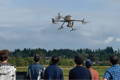
contact@measur.caDrones have become an increasingly important tool in the construction and infrastructure industries. With their ability to capture aerial data and their versatility in various applications, drones are revolutionizing how construction projects are planned, executed, and monitored.
Choose the right drone for your construction operations by considering the information below.

Longer flight times are advantageous for drones in construction applications as they enable them to cover larger areas or complete more tasks in a single flight. This reduces downtime for battery changes and enhances overall efficiency, particularly beneficial for larger construction sites.

Flexibility in sensor integration is crucial for construction operations to adapt to evolving needs.
This involves the ability to incorporate various sensors such as high-resolution cameras, LiDAR, thermal sensors, and others, ensuring versatility and effectiveness in data collection and analysis.

Drone processing software enables seamless processing of aerial data for site surveys and progress tracking. Additional benefits include centralized project information, project collaboration and client-facing deliverables available in the cloud.

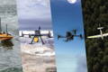
Choosing between a fixed-wing and multirotor drone depends on the project specifics.
Fixed-wing drones are more efficient for large area mapping, while multirotors excel in hovering and close-quarters inspections..
Find the perfect solution for your needs.

By automating tasks like aerial surveying and inspection, drones help reduce labor costs and minimize the need for specialized equipment. Additionally, their efficiency can lead to savings in project management and resource allocation.

Drones can cover large areas quickly, streamlining surveying, mapping, and inspection tasks. This reduces the time and resources needed for data collection and analysis, ultimately speeding up project timelines.

Drones capture high-resolution imagery and data, providing detailed insights into project progress, site conditions, and potential issues. This enables more accurate project planning throughout the construction process.

Drones eliminate the need for workers to access hazardous or hard-to-reach areas manually. This reduces the risk of accidents and injuries, enhancing safety on construction sites.
Drones have transformed large earthworks project mapping in the construction industry, improving efficiency, accuracy, and safety. Equipped with advanced sensors and imaging capabilities, drones rapidly capture high-resolution aerial imagery and topographic data, facilitating streamlined site planning, design optimization, and real-time progress tracking. By reducing the need for manual surveying and providing instant access to aerial footage, drones enhance safety while minimizing costs and project timelines.
The Trinity Pro, with Vertical Take-Off and Landing (VTOL) capability, ensures adaptability to any terrain. With the longest flight time in its class at 90min and high-accuracy sensors, it covers large areas with precision, eliminating the need for Ground Control Points (GCPs). Overall, the Trinity Pro offers unparalleled efficiency, accuracy, and ROI for construction firms.
Drones like the DJI Mavic 3 Enterprise offer unparalleled efficiency and precision at a cost-effective price point. These unmanned aerial vehicles (UAVs) equipped with advanced imaging technology enable construction professionals to swiftly capture high-resolution aerial images and create detailed maps of construction sites.
From assessing terrain features to monitoring progress and identifying potential hazards, the DJI Mavic 3 Enterprise provides survey grade accuracy. Its ability to cover large areas, in a fraction of the time when compared to traditional methods, enhances workflow efficiency while minimizing costs and risks. With drones, construction teams can make informed decisions with confidence, leading to smoother project execution and superior outcomes.

Aerial LiDAR technology offers a groundbreaking solution for mapping potential roadways through dense vegetation. By emitting laser pulses that penetrate foliage and accurately capture terrain data, LiDAR enables engineers and planners to overcome the challenges of traditional surveying methods. This technology provides highly detailed terrain models, allowing for efficient and cost-effective assessment of roadway feasibility.
Moreover, a LiDAR system like the Zenmuse L2 facilitates environmental considerations by providing data on vegetation density and habitat characteristics, ensuring sustainable development practices. Real-world applications demonstrate LiDAR's effectiveness in optimizing roadway designs while minimizing ecological disruption. Overall, LiDAR technology represents a transformative tool for roadway planning in diverse landscapes, promising a more efficient, precise, and environmentally conscious approach to infrastructure development.

Whether assessing bridges, power lines, or pipelines, the DJI Matrice 30T drone empowers inspectors with advanced capabilities, ensuring safer, more efficient, and cost-effective inspection processes for critical infrastructure worldwide.
Drones are revolutionizing infrastructure inspection, and the DJI Matrice 30T stands at the forefront. With an impressive flight time of over 41 minutes, this portable powerhouse is equipped with a multi-sensor camera system, including a high-resolution wide-angle RGB, zoom camera, laser rangefinder, and thermal camera. The Matrice 30T's uncooled VOx Microbolometer 640*512, 30 Hz thermal camera adds an additional layer of capability, enabling inspectors to detect anomalies and assess structural integrity with unparalleled precision.

![[WEBINAR REWIND] How Suncor Utilizes Drones to Manage one of Canada’s Largest Drone Programs with Measur and Flight Insight](http://drones.measur.ca/cdn/shop/articles/1_1193c446-8c2a-4f87-a845-09bbdd65bcfa_120x120.png?v=1713555674)


Whether you need one-on-one or group training, our training programs provide the latest practical knowledge while keeping your budget in mind.
Looking to rent a drone to meet your evolving drone needs?
You'll find a wide range of industry-leading equipment, from DJI drones to advanced LiDAR systems at Measur. We offer cost-effective and convenient solutions for accessing high-quality drone technology without the commitment of ownership.
Give us a call or drop by anytime, we will answer all enquiries within 24 hours on business days. We will be happy to answer your questions.
We would love to hear from you! Our team is always here to help.
+1 866 300 9012
contact@measur.ca
Vancouver, British Columbia
Calgary, Alberta
Mississauga, Ontario
Montreal, Quebec